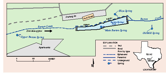
Figure 1. Location of Barton Springs system. Suspended sediment samples were collected from the four spring sites shown; the hydrogeologically connected springs compose the Barton Springs system. Flow in the creek is from left to right.
Contents | Back to Text | Figure 2