Agency
responsible for data collected at sites 15
| Site no. |
Velocity |
Stage |
Discharge |
| 1 |
USGS |
USGS |
USGS |
| 2 |
TWDB |
TWDB |
TWDB |
| 3 |
USGS |
-- |
TWDB |
| 4 |
USGS |
-- |
TWDB |
| 5 |
USGS |
-- |
USGS |
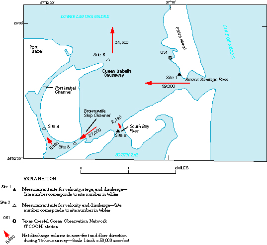
Figure 2. Measurement sites, net discharge volumes, and flow directions in lower Laguna Madre near Port Isabel, Texas, June 19–22, 1997.