
U.S. Geological Survey
Fact Sheet 039-02
Online Version 1.0
The Sea-Floor Mapping Facility at the U.S. Geological Survey
Woods Hole Field Center, Woods Hole, Massachusetts
By Rebecca E. Deusser, William C. Schwab, and Jane F. Denny
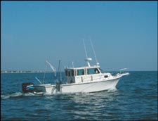
| Researchers of the sea-floor mapping facility at the U.S. Geological Survey (USGS) Woods Hole Field Center in Woods Hole, Mass., use state-of-the-art technology to produce accurate geologic maps of the sea floor. In addition to basic bathymetry and morphology, sea-floor maps may contain information about the distribution of sand resources, patterns of coastal erosion, pathways of pollutant transport, and geologic controls on marine biological habitats. The maps may also show areas of human impacts, such as disturbance by bottom fishing and pollution caused by offshore waste disposal. The maps provide a framework for scientific research and provide critical information to decisionmakers who oversee resources in the coastal ocean. | ||
U.S. Department of the Interior, U.S. Geological Survey
URL: https://pubsdata.usgs.gov/pubs/fs/fs039-02/index.html
For more information, contact William C. Schwab or William W. Danforth
Maintained by Eastern Publications Group
Last modified: 17:51:31 Tue 29 Nov 2016
Privacy statement | General disclaimer | Accessibility