

|
|
|
|
|
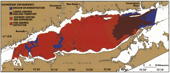
| Figure 4. Reconnaissance map showing the distribution of sedimentary environments across the Long Island Sound estuary. Sedimentary environments have been inferred from sonograph patterns, sediment samples, video-camera observations, and modeled current and wave data. The 10-meter (33-foot) depth contour delineates the shoreward limit of the study area along the Connecticut and Long Island coasts. |
 |