

|
|
|
|
|
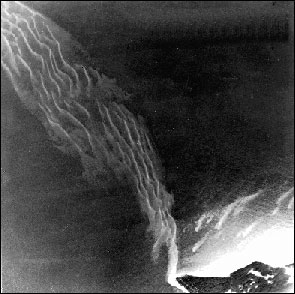
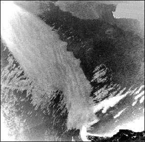
| Aerial photographs of Escollo de Arenas, a shoal off the northeast corner of Vieques Island composed of 90 million cubic meters of sand and gravel, before (left) and after (right) the impact of Hurricane Hugo. Note the sand ridges were suppressed by storm-induced currents and waves. The distance across the photographs from top to bottom is approximately 2 kilometers. Top is north. | |
 |
 |