Link to USGS home page Link to USGS home page
Coastal and Marine Geology Program
Coastal and Marine Geology Program > Seafloor Images Refine Petroleum Exploration Models

Seafloor Images Refine Petroleum Exploration Models

USGS Fact Sheet
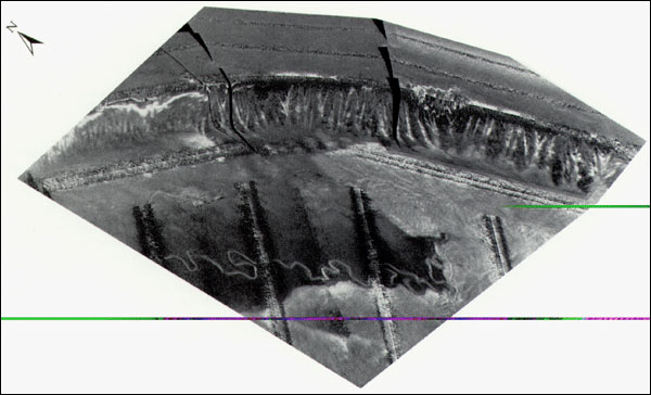
GLORIA imagery can be draped ocer National Oceanic and Atmospheric Administration bathymetry to create three-dimensional images that facilitate analysis. The perspective view shows the Florida Escarpment cut by gullies and a meandering submarine channel formed at water depths of more than 3,000 meters along the escarpment's base. Also shown are mass-wasting deposits (light tones) that bury the channel and originated in the Mississippi Canyon 500 kilometers to the northwest.
Florida Escarpment cut by gullies and a meandering submarine channel formed at water depths of more than 3,000 meters along the escarpment's base.
Coastal and Marine Geology Program > Seafloor Images Refine Petroleum Exploration Models
[an error occurred while processing this directive]