General Information Product 102
¹ Parallel, Inc., P.O. Box 281149, Lakewood, CO 80228
² USGS Rocky Mountain Geographic Science Center, P.O. Box 25046, MS-516, Denver, CO 80225

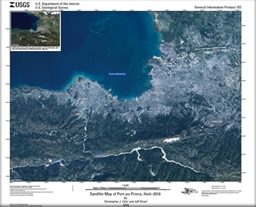
The U.S. Geological Survey produced 1:24,000-scale post-earthquake image base maps incorporating high- and medium-resolution remotely sensed imagery following the 7.0 magnitude earthquake near the capital city of Port au Prince, Haiti, on January 12, 2010. Commercial 2.4-meter multispectral QuickBird imagery was acquired by DigitalGlobe on January 15, 2010, following the initial earthquake. Ten-meter multispectral ALOS AVNIR-2 imagery was collected by the Japanese Space Agency (JAXA) on January 12, 2010. These data were acquired under the Remote Sensing International Charter, a global team of space and satellite agencies that provide timely imagery in support of emergency response efforts worldwide. The images shown on this map were employed to support earthquake response efforts, specifically for use in determining ground deformation, damage assessment, and emergency management decisions. The raw, unprocessed imagery was geo-corrected, mosaicked, and reproduced onto a cartographic 1:24,000-scale base map. These maps are intended to provide a temporally current representation of post-earthquake ground conditions, which may be of use to decision makers and to the general public. |
First posted March 10, 2010 For additional information contact: Part or all of this report is presented in Portable Document Format (PDF); the latest version of Adobe Reader or similar software is required to view it. Download the latest version of Adobe Reader, free of charge. |
Cole, C.J., and Sloan, Jeff, 2010, Satellite map of Port-Au-Prince, Haiti–2010–Natural color: U.S. Geological Survey General Information Product 102, scale 1:24,000.