Summary
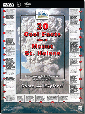
Commemorating the 30th anniversary of the 1980 eruptions of Mount St. Helens
1—During the past 4,000 years, Mount St. Helens has erupted more frequently than any other volcano in the Cascade Range.
2—Most of Mount St. Helens is younger than 3,000 years old (younger than the pyramids of Egypt).
3—Some Native American names that refer to smoke at the volcano include— Lawala Clough, Low-We- Lat-Klah, Low-We-Not- Thlat, Loowit, Loo-wit, Loo-wit Lat-kla, and Louwala-Clough.
4—3,600 years ago—Native Americans abandoned hunting grounds devastated by an enormous eruption four times larger than the May 18, 1980 eruption.
5—1792—Captain George Vancouver named the volcano for Britain’s ambassador to Spain, Alleyne Fitzherbert, also known as Baron St. Helens.
6—1975—U.S. Geological Survey geologists forecasted that Mount St. Helens would erupt again, “possibly before the end of the century.”
7—March 20, 1980—A magnitude 4.2 earthquake signaled the reawakening of the volcano after 123 years.
8—Spring 1980—Rising magma pushed the volcano’s north flank outward 5 feet per day.
9—Morning of May 18, 1980— The largest terrestrial landslide in recorded history reduced the summit by 1,300 feet and triggered a lateral blast.
10—Within 3 minutes, the lateral blast, traveling at more than 300 miles per hour, blew down and scorched 230 square miles of forest.
11—Within 15 minutes, a vertical plume of volcanic ash rose over 80,000 feet.
12—Afternoon of May 18, 1980—The dense ash cloud turned daylight into darkness in eastern Washington, causing streetlights to turn on in Yakima and Ritzville.
13—The volcanic ash cloud drifted east across the United States in 3 days and encircled Earth in 15 days.
14—Lahars (volcanic mudflows) filled rivers with rocks, sand, and mud, damaging 27 bridges and 200 homes and forcing 31 ships to remain in ports upstream.
15—The May 18, 1980 eruption was the most economically destructive volcanic event in U.S. history.
16—Small plants and trees beneath winter snow, and roots protected by soil, survived the May 18, 1980 eruption and now thrive.
17—Thousands of birds, mammals, reptiles, amphibians, and millions of hatchery fingerlings perished in the eruption.
18—Late May 1980—Wind-dispersed spiders and scavenging beetles were among the first animals to return to the Mount St. Helens area.
19—The landscape devastated by the eruption has evolved into a rich and diverse habitat for plants and animals.
20—Effects of the May 18, 1980 eruption continue today. Biologists help wild salmon and steelhead by giving them a tank-truck ride to the pristine, clear creeks above sediment-choked rivers.
21—Late spring through fall 1980—Explosive eruptions on May 25, June 12, July 22, August 7, and October 16–18 rocked Mount St. Helens and sent ash to distant communities.
22—1982—Mount St. Helens National Volcanic Monument was established for all to observe both the awesome destruction and the remarkable recovery of plants and animals.
23—October 1980 to 1986— Over the course of 17 episodes, lava eruptions began filling the crater, building a lava dome that reached 876 feet above the crater floor.
24—Since 1986, snow and rock accumulating in the deep, shaded crater formed Crater Glacier, the youngest glacier on Earth.
25—September 2004—Mount St. Helens reawakened, and it erupted continuously until January 2008.
26—October 2004 to January 2008—Growing lava domes displaced and then divided Crater Glacier into east and west lobes. The ice lobes moved downslope as fast as 6 feet per day, converging below the lava dome a little more than three years later.
27—During the 2004 to 2008 eruptions—Mount St. Helens settled one half inch due to magma withdrawal beneath the volcano.
28—The Global Positioning System (GPS) instrument that detected the settling of Mount St. Helens can detect movement of as little as 1/16 of an inch and uses less power than a refrigerator lightbulb.
29—During the 1980 to 1986 and the 2004 to 2008 eruptions—Lava oozed onto the crater floor, building domes taller than the Empire State Building and restoring 7 percent of the volume lost in 1980.
30—Mount St. Helens remains a world-famous natural laboratory for the study of Earth’s processes and also nature’s response to catastrophe.
|
-
This report is also available in print from:
USGS Information Services, Box 25286,
Federal Center, Denver, CO 80225
telephone: 888 ASK-USGS; e-mail: infoservices@usgs.gov
This report is presented in Portable Document Format (PDF); the latest version of Adobe Reader or similar software is required to view it. Download the latest version of Adobe Reader, free of charge. |

