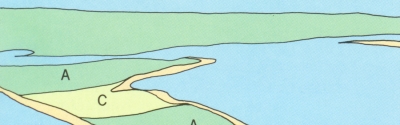
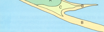
Figure 22.
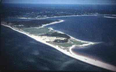
Wellfleet Harbor occupies a depression that was formed when ice, possibly a sublobe of the South Channel lobe, prevented outwash deposition. The islands (A) are composed of Wellfleet outwash plain deposits that filled holes or depressions in the ice. The islands are tied together and to the mainland by spits called tombolos (B) composed of sand eroded from the cliffed Cape Cod Bay shore to the north of the harbor. Once the tombolos were in place, they provided protection from waves and marsh deposits (C) formed in the sheltered water (photo by National Seashore Park Service).
 |
|