
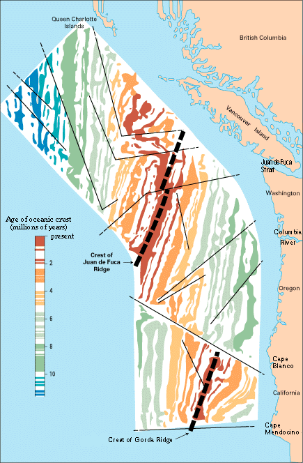
The center part of the figure -- representing the deep ocean floor with the sea magically removed -- shows the magnetic striping (see text) mapped by oceanographic surveys offshore of the Pacific Northwest. Thin black lines show transform faults (discussed later) that offset the striping.
![]() U.S. Department of the Interior |
U.S. Geological Survey
U.S. Department of the Interior |
U.S. Geological Survey
URL: https://pubsdata.usgs.gov/pubs/gip/dynamic/magnetic.html
Page Contact Information: Molly Newbrough or Pubs Warehouse
Page Last Modified: Friday, July 11, 2025, 12:56:35 PM