Kilauea Volcano. Kilauea's longest rift-zone eruption in historical time began on January 3, 1983. A row of lava fountains broke out from its east rift zone about 17 kilometers from the summit caldera; within a few months, the activity settled down to a single vent. Powerful fountaining episodes hurled molten rock 450 meters into the air and built a cone of lava fragments that quickly became the tallest landmark on the rift zone.
The eruption changed style abruptly in July 1986 when lava broke out through a new vent. Instead of regular episodes of high lava fountaining, lava spilled continuously onto Kilauea's surface. The steady outpouring of lava formed a lake of molten rock that became perched atop a small shield volcano. By June 1991, the shield was about 60 meters tall and 1,600 meters in diameter, and lava from the eruption had covered 75 square kilometers of forest and grassland, added 120 hectares of new land to the island, and destroyed 179 homes.
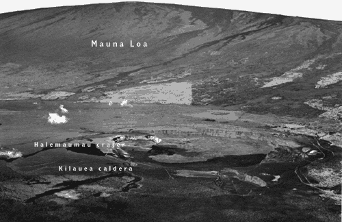
Areal view of Hawaii's two most active volcanoes, Kilauea and Mauna Loa. (Photograph by J.D. Griggs.)
<https://pubs.usgs.gov/gip/volcus/page13.html>
Maintained by John Watson
Updated 01.26.99
![]()
![]()
![]()