<https://pubs.usgs.gov/gip/volcus/page39.html>
Maintained by John Watson
Updated 06.24.97
![]()
![]()
![]()
| |
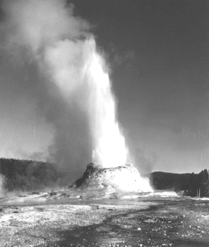
| The Earth's crust beneath Yellowstone National Park is still restless. Precise surveys have detected an area in the center of the caldera that rose by as much as 86 centimeters between 1923 and 1984 and then subsided slightly between 1985 and 1989. Scientists do not know the cause of these ups and downs but hypothesize that they are related to the addition or withdrawal of magma beneath the caldera, or to the changing pressure of the hot ground water system above Yellowstone's large magma reservoir. Also, Yellowstone National Park and the area immediately west of the Park are historically among the most seismically active areas in the Rocky Mountains. Small-magnitude earthquakes are common beneath the entire caldera, but most are located along the Hebgen Lake fault zone that extends into the northwest part of the caldera. A magnitude 7.5 earthquake occurred along this zone in 1959. | Castle Geyser erupting a column of hot water, Yellowstone National Park. (Photograph by Steven R. Brantley.) |
<https://pubs.usgs.gov/gip/volcus/page39.html> |
|