GROUND WATER ATLAS of the UNITED STATES
Introduction and National Summary
Sandstone aquifers
There are two different files for each illustration
- A 72 ppi GIF file, suitable for screen viewing is accessed
through the thumbnail image.
- An eps file, suitable for downloading to be printed or edited
is accessed through the "eps file" link. Most files
are Adobe Illustrator 6.0, exceptions are noted. These files
have been compressed with GNU's gzip utility. If your web browser
defaults to a screen display of the file, turn on the "Load
to local disk" option before downloading. Download and process
these eps files as ascii, not binary.
Sandstone aquifers
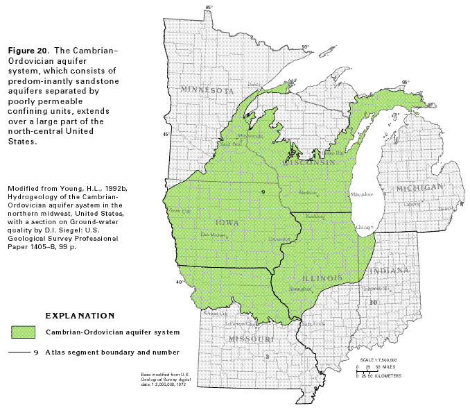
Figure 20 Map showing the location of the Cambrian-Ordovician
aquifer system (48K)
 editable eps file A020.eps.gz
(228K compressed)
editable eps file A020.eps.gz
(228K compressed)
Figure 21 Correlation chart showing the
geologic formations that comprise the Cambrian-Ordovician aquifer
system (16K)
 editable eps file A021.eps.gz
(16K compressed)
editable eps file A021.eps.gz
(16K compressed)
Figure 22 Map showing the top-of-aquifer contours
of the Mount Simon aquifer (52K)
 editable eps file A022.eps.gz
(240K compressed)
editable eps file A022.eps.gz
(240K compressed)
Figure 23 Map showing the movement of water
through the St. Peter-Prairie du Chien-Jordan aquifer (44K)
 editable eps file A023.eps.gz
(256K compressed)
editable eps file A023.eps.gz
(256K compressed)
Figure 24 Map showing water level decline in the
Cambrian-Ordovician aquifer system (40K)
 editable eps file A024.eps.gz
(164K compressed)
editable eps file A024.eps.gz
(164K compressed)
Figure 25 Hydrogeologic section showing
flow of ground-water through the sandstone aquifers in southeastern
Minnesota (40K)
 editable eps file A025.eps.gz
(120K compressed)
editable eps file A025.eps.gz
(120K compressed)
Figure 26 Map showing the dissolved-solids
concentrations in water from the St. Peter-Prairie du Chien-Jordan
aquifer (40K)
 editable eps file A026.eps.gz
(268K compressed)
editable eps file A026.eps.gz
(268K compressed)
 editable eps file A020.eps.gz
(228K compressed)
editable eps file A020.eps.gz
(228K compressed) 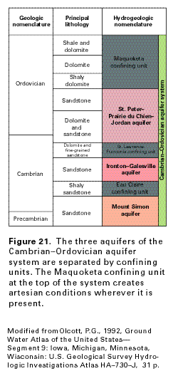 editable eps file A021.eps.gz
(16K compressed)
editable eps file A021.eps.gz
(16K compressed) 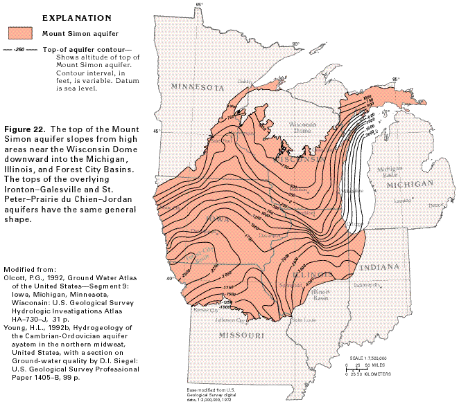 editable eps file A022.eps.gz
(240K compressed)
editable eps file A022.eps.gz
(240K compressed) 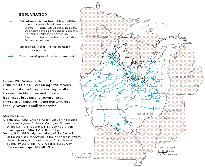 editable eps file A023.eps.gz
(256K compressed)
editable eps file A023.eps.gz
(256K compressed) 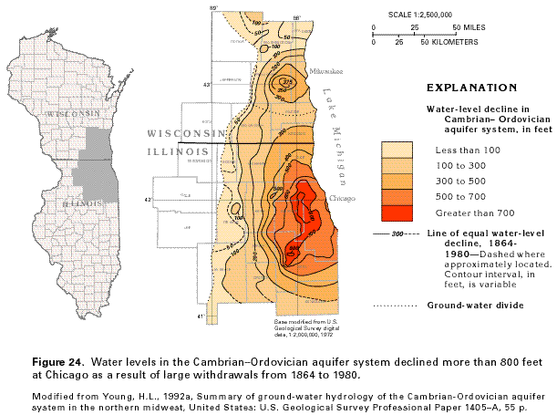 editable eps file A024.eps.gz
(164K compressed)
editable eps file A024.eps.gz
(164K compressed)  editable eps file A025.eps.gz
(120K compressed)
editable eps file A025.eps.gz
(120K compressed) 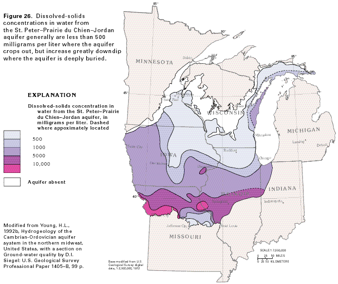 editable eps file A026.eps.gz
(268K compressed)
editable eps file A026.eps.gz
(268K compressed)