GROUND WATER ATLAS of the UNITED STATES
Introduction and National Summary
Semiconsolidated sand aquifers
There are two different files for each illustration
- A 72 ppi GIF file, suitable for screen viewing is accessed
through the thumbnail image.
- An eps file, suitable for downloading to be printed or edited
is accessed through the "eps file" link. Most files
are Adobe Illustrator 6.0, exceptions are noted. These files
have been compressed with GNU's gzip utility. If your web browser
defaults to a screen display of the file, turn on the "Load
to local disk" option before downloading. Download and process
these eps files as ascii, not binary.
Semiconsolidated sand aquifers
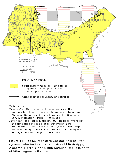
Figure 14 Map showing the location of the Southeastern Coastal
Plain aquifer system (32K)
 editable eps file A014.eps.gz
(340K compressed)
editable eps file A014.eps.gz
(340K compressed)
Figure 15 Correlation chart showing the
geologic formations that comprise the Southeastern Coastal Plain
aquifer system (36K)
 editable eps file A015.eps.gz
(52K compressed)
editable eps file A015.eps.gz
(52K compressed)
Figure 16 Map showing the outcrop area of the Pearl
River aquifer (36K)
 editable eps file A016.eps.gz
(488K compressed)
editable eps file A016.eps.gz
(488K compressed)
Figure 17 Map showing the outcrop area of
the Chattahoochee River aquifer (40K)
 editable eps file A017.eps.gz
(484K compressed)
editable eps file A017.eps.gz
(484K compressed)
Figure 18 Map showing the outcrop area of the Black
Warrior River aquifer (40K)
 editable eps file A018.eps.gz
(468K compressed)
editable eps file A018.eps.gz
(468K compressed)
Figure 19 Diagrammatic section showing the
general movement of water in the Southeastern Coastal Plain aquifer
system in southeast Georgia (32K)
 This illustration contains a placed image. Download the Adobe Illustrator
6 eps file A019.eps.gz (80K compressed)
which contains an imbedded Adobe Photoshop 3 (eps) file. You may also want
to download the editable Photoshop
file A019ph.eps.gz (52K compressed)
This illustration contains a placed image. Download the Adobe Illustrator
6 eps file A019.eps.gz (80K compressed)
which contains an imbedded Adobe Photoshop 3 (eps) file. You may also want
to download the editable Photoshop
file A019ph.eps.gz (52K compressed)
 editable eps file A014.eps.gz
(340K compressed)
editable eps file A014.eps.gz
(340K compressed) 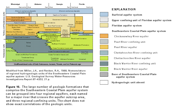 editable eps file A015.eps.gz
(52K compressed)
editable eps file A015.eps.gz
(52K compressed) 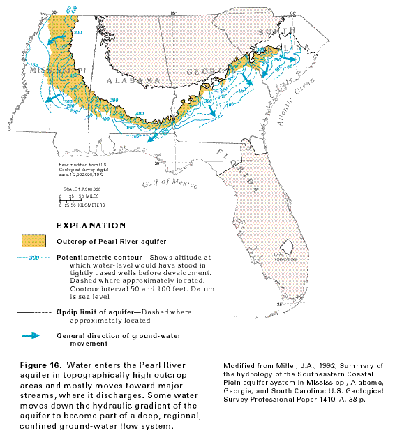 editable eps file A016.eps.gz
(488K compressed)
editable eps file A016.eps.gz
(488K compressed) 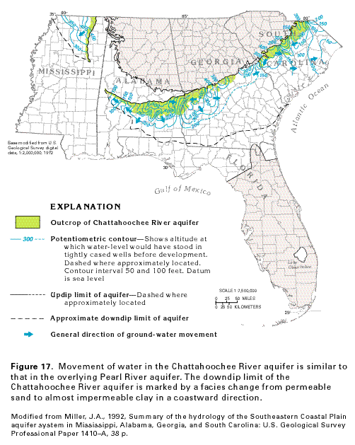 editable eps file A017.eps.gz
(484K compressed)
editable eps file A017.eps.gz
(484K compressed) 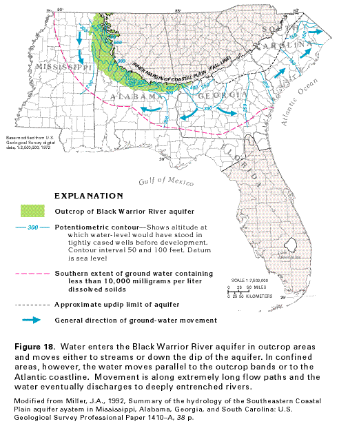 editable eps file A018.eps.gz
(468K compressed)
editable eps file A018.eps.gz
(468K compressed) 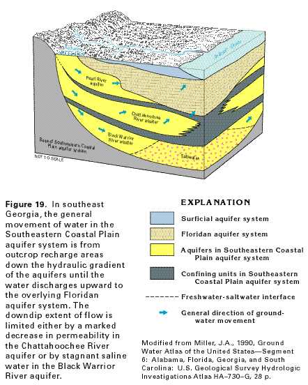 This illustration contains a placed image. Download the Adobe Illustrator
6 eps file A019.eps.gz (80K compressed)
which contains an imbedded Adobe Photoshop 3 (eps) file. You may also want
to download the editable Photoshop
file A019ph.eps.gz (52K compressed)
This illustration contains a placed image. Download the Adobe Illustrator
6 eps file A019.eps.gz (80K compressed)
which contains an imbedded Adobe Photoshop 3 (eps) file. You may also want
to download the editable Photoshop
file A019ph.eps.gz (52K compressed)