GROUND WATER ATLAS of the UNITED STATES
Introduction and National Summary
Unconsolidated sand and gravel aquifers
There are two different files for each illustration
- A 72 ppi GIF file, suitable for screen viewing is accessed
through the thumbnail image.
- An eps file, suitable for downloading to be printed or edited
is accessed through the "eps file" link. Most files
are Adobe Illustrator 6.0, exceptions are noted. These files
have been compressed with GNU's gzip utility. If your web browser
defaults to a screen display of the file, turn on the "Load
to local disk" option before downloading. Download and process
these eps files as ascii, not binary.
Blanket sand and gravel aquifers
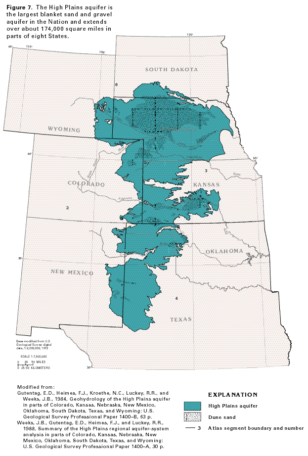
Figure 7 Map showing the location of the High Plains aquifer
(56K)
 editable eps file A007.eps.gz
(308K compressed)
editable eps file A007.eps.gz
(308K compressed)
Figure 8 Graph showing ground-water withdrawals
from the High Plains aquifer for irrigation (24K)
 editable eps file A008.eps.gz
(24K compressed)
editable eps file A008.eps.gz
(24K compressed)
Figure 9 Map showing water level change in the
High Plains aquifer from predevelopment conditions to 1980 (56K)
 editable eps file A009.eps.gz
(268K compressed)
editable eps file A009.eps.gz
(268K compressed)
Figure 10 Map showing change in saturated-thickness
in the High Plains aquifer from predevelopment conditions to 1980
(52K)
 editable eps file A010.eps.gz
(248K compressed)
editable eps file A010.eps.gz
(248K compressed)
Figure 11 Map showing direction of water
movement in the High Plains aquifer (52K)
 editable eps file A011.eps.gz
(296K compressed)
editable eps file A011.eps.gz
(296K compressed)
 editable eps file A007.eps.gz
(308K compressed)
editable eps file A007.eps.gz
(308K compressed) 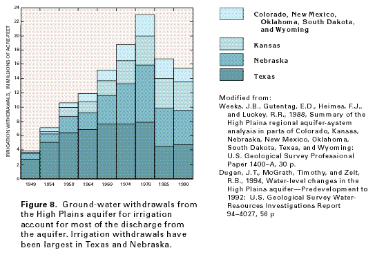 editable eps file A008.eps.gz
(24K compressed)
editable eps file A008.eps.gz
(24K compressed) 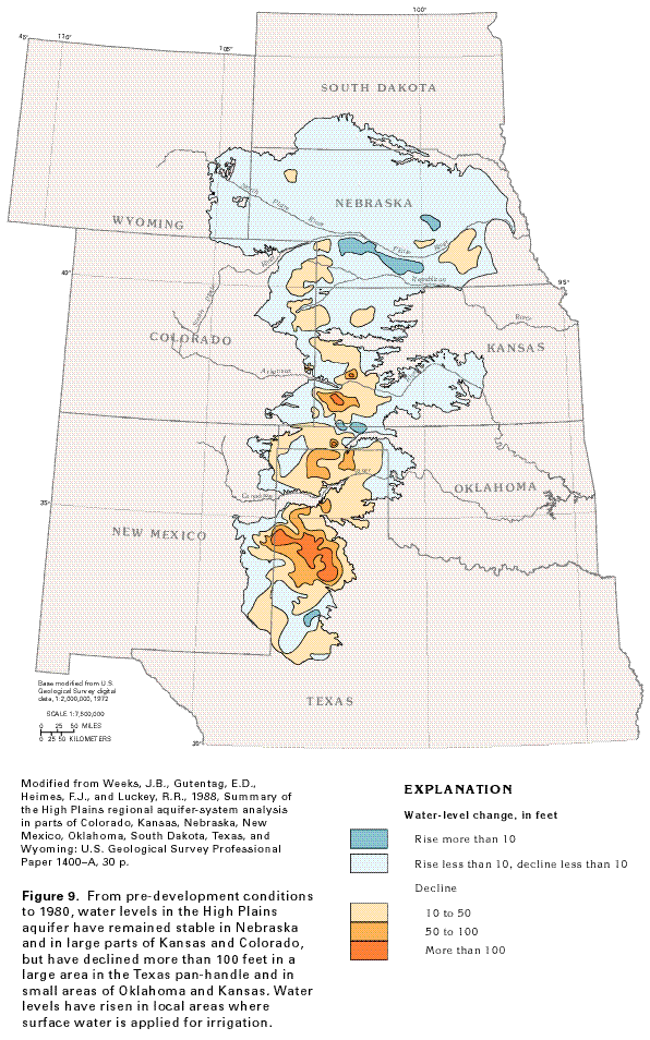 editable eps file A009.eps.gz
(268K compressed)
editable eps file A009.eps.gz
(268K compressed) 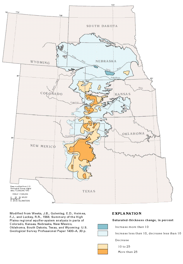 editable eps file A010.eps.gz
(248K compressed)
editable eps file A010.eps.gz
(248K compressed) 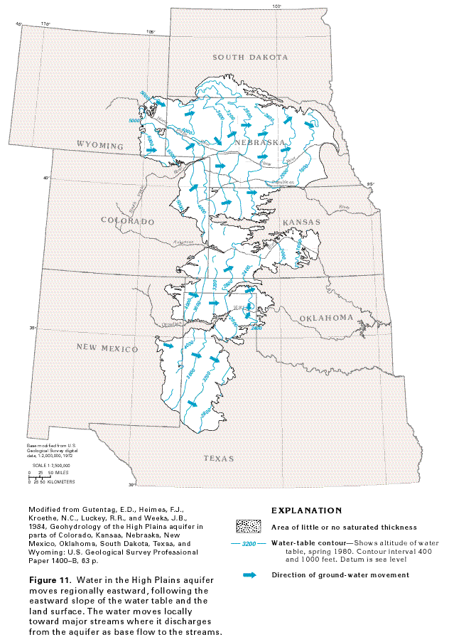 editable eps file A011.eps.gz
(296K compressed)
editable eps file A011.eps.gz
(296K compressed)