GROUND WATER ATLAS of the UNITED STATES
Introduction and National Summary
Unconsolidated sand and gravel aquifers
There are two different files for each illustration
- A 72 ppi GIF file, suitable for screen viewing is accessed
through the thumbnail image.
- An eps file, suitable for downloading to be printed or edited
is accessed through the "eps file" link. Most files
are Adobe Illustrator 6.0, exceptions are noted. These files
have been compressed with GNU's gzip utility. If your web browser
defaults to a screen display of the file, turn on the "Load
to local disk" option before downloading. Download and process
these eps files as ascii, not binary.
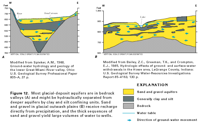
Glacial deposit aquifers
Figure 12 Diagram showing the structures of the valley-fill
glacial deposit aquifers and of the glacial outwash plains aquifers
(24K)
 editable eps file A012.eps.gz
(28K compressed)
editable eps file A012.eps.gz
(28K compressed)
Figure 13 Map showing water flow in the
valley-fill glacial-deposit aquifer of the Little Androscoggin
River valley in southwestern Maine (48K)
 editable eps file A013.eps.gz
(116K compressed)
editable eps file A013.eps.gz
(116K compressed)
 editable eps file A012.eps.gz
(28K compressed)
editable eps file A012.eps.gz
(28K compressed) 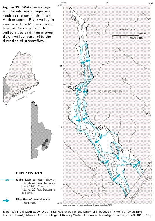 editable eps file A013.eps.gz
(116K compressed)
editable eps file A013.eps.gz
(116K compressed)