GROUND WATER ATLAS of the UNITED STATES
California, Nevada
HA 730-B
Basin and Range aquifers
There are two different files for each illustration
- A 72 ppi GIF file, suitable for screen viewing is accessed through
the thumbnail image
- An eps file, suitable for downloading to be printed or edited is accessed
through the "eps file" link. Most files are Adobe Illustrator
5.5, exceptions are noted. These files have been compressed with GNU's gzip
utility. If your web browser defaults to a screen display of the file, turn
on the "Load to local disk" option before downloading. Download
and process these eps files as ascii, not binary.
Ground-water flow systems - -Single, undrained closed basin
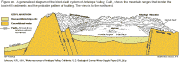
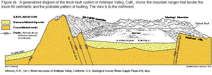
Figure 26 Generalized diagram of Antelope Valley, CA closed basin (18K)
 This illustration contains a placed image. Download the Adobe Illustrator
6 eps
file b026.eps (128K compressed) which contains an imbedded Adobe Photoshop
3 (eps) file. You may also want to download the editable
Photoshop file b26psh.eps.gz(5.5M compressed)
This illustration contains a placed image. Download the Adobe Illustrator
6 eps
file b026.eps (128K compressed) which contains an imbedded Adobe Photoshop
3 (eps) file. You may also want to download the editable
Photoshop file b26psh.eps.gz(5.5M compressed)
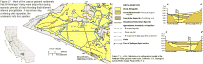
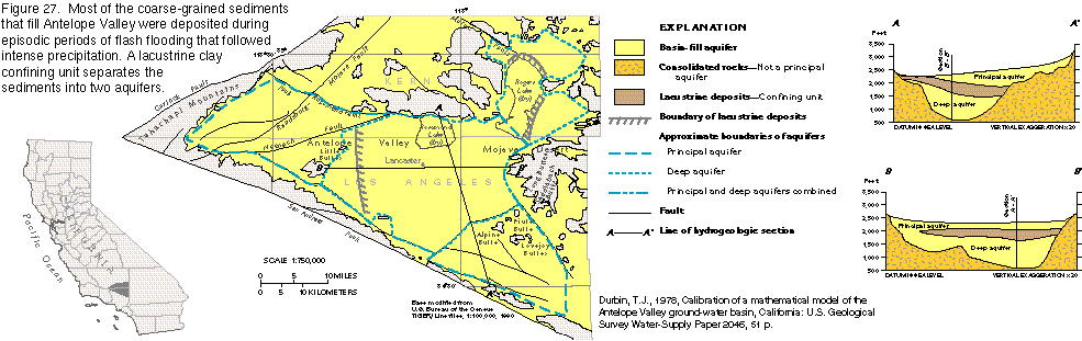
Figure 27 Map of Antelope
Valley (28K)
 editable
eps
file b027.eps (129K compressed)
editable
eps
file b027.eps (129K compressed)
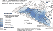
Figure 28 Map of transmissivity, principal aquifer in Antelope Valley
(20K)
 editable eps
file b028.eps (112K compressed)
editable eps
file b028.eps (112K compressed)
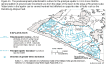
Figure 29 Map of transmissivity, deep aquifer in Antelope Valley (18K)
 editable
eps
file b029.eps (104K compressed)
editable
eps
file b029.eps (104K compressed)
Figure 30 Map of predevelopment potentiometric surface, deep aquifer
in Antelope Valley (20K)
 editable eps
file b030.eps (109K compressed)
editable eps
file b030.eps (109K compressed)
Figure 31 Map of 1961 potentiometric surface, principal aquifer in Antelope
Valley (21K)
 editable eps
file b031.eps (112 compressed)
editable eps
file b031.eps (112 compressed)
Figure 32 Graph of withdrawals, principal aquifer in Antelope Valley
(9K)
 editable eps
file b032.eps (12K compressed)
editable eps
file b032.eps (12K compressed)
Figure 33 Graph of evapotranspiration, principal aquifer in Antelope
Valley (6K)
 editable
eps
file b033.eps (11K compressed)
editable
eps
file b033.eps (11K compressed)
Figure 34 Map of ground-water quality, Antelope Valley (17K)
 editable eps
file b034.eps (104K compressed)
editable eps
file b034.eps (104K compressed)
 editable
eps
file b027.eps (129K compressed)
editable
eps
file b027.eps (129K compressed) 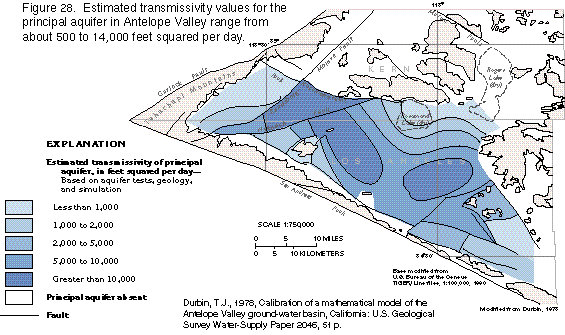 editable eps
file b028.eps (112K compressed)
editable eps
file b028.eps (112K compressed) 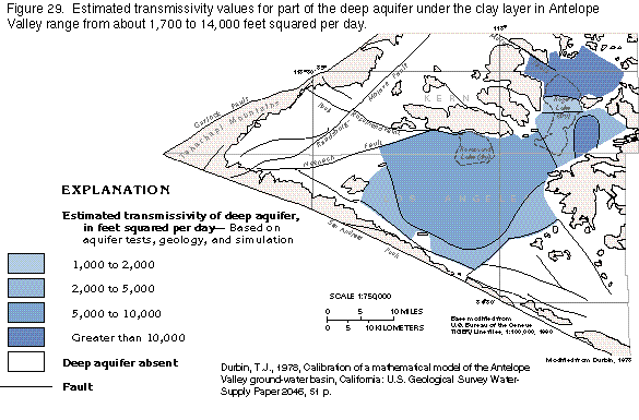 editable
eps
file b029.eps (104K compressed)
editable
eps
file b029.eps (104K compressed)  editable eps
file b030.eps (109K compressed)
editable eps
file b030.eps (109K compressed) 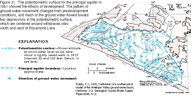 editable eps
file b031.eps (112 compressed)
editable eps
file b031.eps (112 compressed) 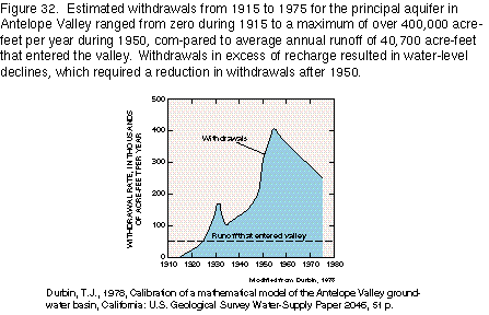 editable eps
file b032.eps (12K compressed)
editable eps
file b032.eps (12K compressed) 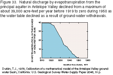 editable
eps
file b033.eps (11K compressed)
editable
eps
file b033.eps (11K compressed)  editable eps
file b034.eps (104K compressed)
editable eps
file b034.eps (104K compressed)