GROUND WATER ATLAS of the UNITED STATES
California, Nevada
HA 730-B
Basin and Range aquifers
There are two different files for each illustration
- A 72 ppi GIF file, suitable for screen viewing is accessed through
the thumbnail image
- An eps file, suitable for downloading to be printed or edited is accessed
through the "eps file" link. Most files are Adobe Illustrator
5.5, exceptions are noted. These files have been compressed with GNU's gzip
utility. If your web browser defaults to a screen display of the file, turn
on the "Load to local disk" option before downloading. Download
and process these eps files as ascii, not binary.
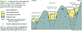
Ground-water flow systems - -Partly drained, closed basin
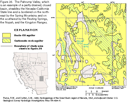
Figure 35 Map of Pahrump Valley, Nevada, California, closed basin (29K)
 editable eps
file b035.eps (109K compressed)
editable eps
file b035.eps (109K compressed)
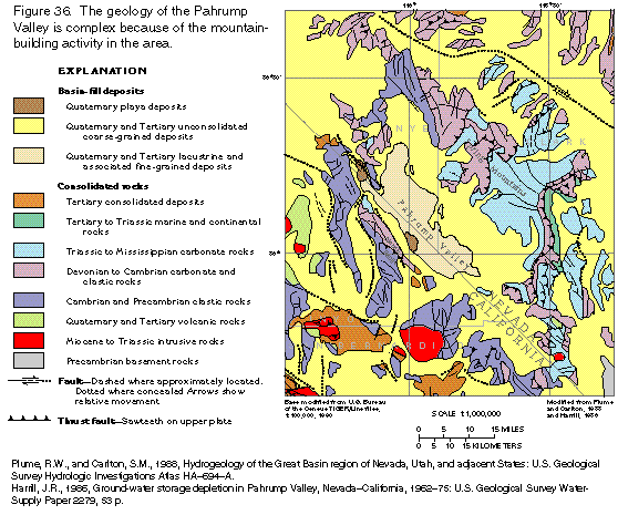
Figure 36 Map of Pahrump Valley
geology (31K)
 editable
eps
file b036.eps (139K compressed)
editable
eps
file b036.eps (139K compressed)
Figure 37 Diagrammatic section of Pahrump Valley aquifers (15K)
 editable eps
file b037.eps (43K compressed)
editable eps
file b037.eps (43K compressed)
Figure 38 Map of thickness of basin-fill materials, Pahrump Valley (38K)
 editable
eps
file b038.eps (85K compressed)
editable
eps
file b038.eps (85K compressed)
Figure 39 Map of transmissivity, Pahrump Valley (23K)
 editable eps
file b039.eps (83K compressed)
editable eps
file b039.eps (83K compressed)
 editable
eps
file b036.eps (139K compressed)
editable
eps
file b036.eps (139K compressed) 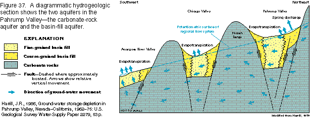 editable eps
file b037.eps (43K compressed)
editable eps
file b037.eps (43K compressed) 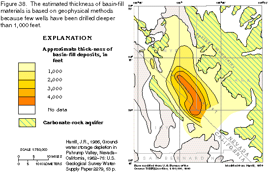 editable
eps
file b038.eps (85K compressed)
editable
eps
file b038.eps (85K compressed) 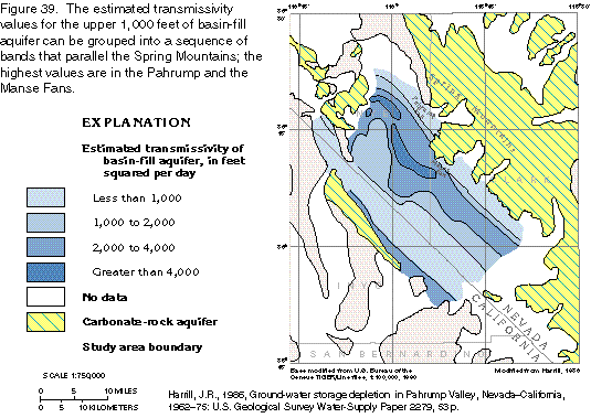 editable eps
file b039.eps (83K compressed)
editable eps
file b039.eps (83K compressed)