GROUND WATER ATLAS of the UNITED STATES
California, Nevada
HA 730-B
Basin and Range aquifers
There are two different files for each illustration
- A 72 ppi GIF file, suitable for screen viewing is accessed through
the thumbnail image
- An eps file, suitable for downloading to be printed or edited is accessed
through the "eps file" link. Most files are Adobe Illustrator
5.5, exceptions are noted. These files have been compressed with GNU's gzip
utility. If your web browser defaults to a screen display of the file, turn
on the "Load to local disk" option before downloading. Download
and process these eps files as ascii, not binary.
Ground-water flow systems - -Terminal sink basin
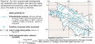
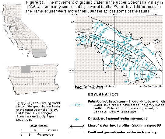
Figure 53 Map of 1936 potentiometric contours, upper Coachella Valley (21K)
 editable eps
file b053.eps.gz (61K compressed)
editable eps
file b053.eps.gz (61K compressed)
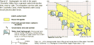
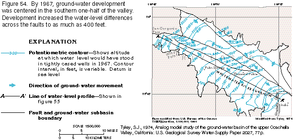
Figure 54 Map of 1967 potentiometric
contours, upper Coachella Valley (16K)
 editable
eps
file b054.eps.gz (42K compressed)
editable
eps
file b054.eps.gz (42K compressed)
Figure 55 Diagram comparing 1936 and 1967 water-level profiles, upper
Coachella Valley (7K)
 editable eps
file b055.eps.gz (14K compressed)
editable eps
file b055.eps.gz (14K compressed)
Figure 56 Graph of ground-water withdrawals, 1936-1967, upper Coachella
Valley (8K)
 editable
eps
file b056.eps.gz (10K compressed)
editable
eps
file b056.eps.gz (10K compressed)
Figure 57 Map of water-level rise, Imperial Valley, California (15K)
 editable eps
file b057.eps.gz (38K compressed)
editable eps
file b057.eps.gz (38K compressed)
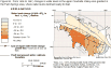
Figure 58 Map of water-level change 1936-1967, upper Coachella Valley
(18K)
 editable eps
file b058.eps.gz (45K compressed)
editable eps
file b058.eps.gz (45K compressed)
Figure 59 Graph of accumulated departure from long-term average precipitation
(10K)
 editable eps
file b059.eps.gz (12K compressed)
editable eps
file b059.eps.gz (12K compressed)
 editable
eps
file b054.eps.gz (42K compressed)
editable
eps
file b054.eps.gz (42K compressed) 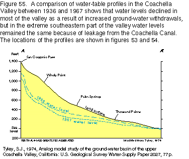 editable eps
file b055.eps.gz (14K compressed)
editable eps
file b055.eps.gz (14K compressed) 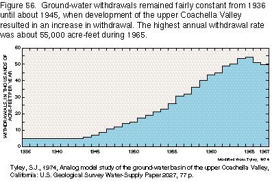 editable
eps
file b056.eps.gz (10K compressed)
editable
eps
file b056.eps.gz (10K compressed) 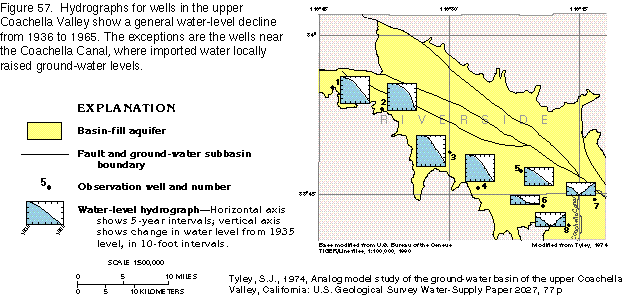 editable eps
file b057.eps.gz (38K compressed)
editable eps
file b057.eps.gz (38K compressed)  editable eps
file b058.eps.gz (45K compressed)
editable eps
file b058.eps.gz (45K compressed) 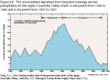 editable eps
file b059.eps.gz (12K compressed)
editable eps
file b059.eps.gz (12K compressed)