GROUND WATER ATLAS of the UNITED STATES
California, Nevada
HA 730-B
Basin and Range aquifers
There are two different files for each illustration
- A 72 ppi GIF file, suitable for screen viewing is accessed through
the thumbnail image
- An eps file, suitable for downloading to be printed or edited is accessed
through the "eps file" link. Most files are Adobe Illustrator
5.5, exceptions are noted. These files have been compressed with GNU's gzip
utility. If your web browser defaults to a screen display of the file, turn
on the "Load to local disk" option before downloading. Download
and process these eps files as ascii, not binary.
Ground-water flow systems - -Connected basin flow system
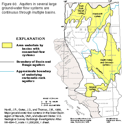
Figure 60 Map of multi-basin ground-water flow systems (18K)
 editable eps
file b060.eps.gz (54K compressed)
editable eps
file b060.eps.gz (54K compressed)
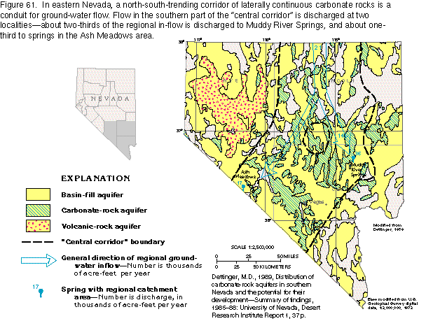
Figure 61 Map of corridor of laterally
continuous carbonate rocks (29K)
 editable
eps
file b061.eps.gz (151K compressed)
editable
eps
file b061.eps.gz (151K compressed)
Figure 62 Map of altitude, White River/Muddy River Springs area, Nevada
(25K)
 editable eps
file b062.eps.gz (87K compressed)
editable eps
file b062.eps.gz (87K compressed)
Figure 63 Map of geology, White River/Muddy River Springs area (22K)
 editable eps
file b063.eps.gz (94K compressed)
editable eps
file b063.eps.gz (94K compressed)
Figure 64 Map of ground-water movement, White River/Muddy River Springs
area (22K)
 editable eps
file b064.eps.gz (63K compressed)
editable eps
file b064.eps.gz (63K compressed)
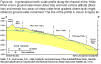
Figure 65 Diagram comparing elevation of water level and land surface
(7K)
 editable eps
file b065.eps.gz (11K compressed)
editable eps
file b065.eps.gz (11K compressed)
 editable
eps
file b061.eps.gz (151K compressed)
editable
eps
file b061.eps.gz (151K compressed) 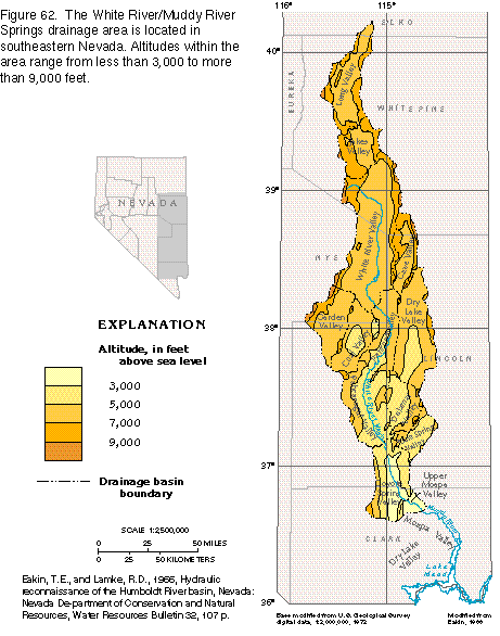 editable eps
file b062.eps.gz (87K compressed)
editable eps
file b062.eps.gz (87K compressed)  editable eps
file b064.eps.gz (63K compressed)
editable eps
file b064.eps.gz (63K compressed) 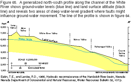 editable eps
file b065.eps.gz (11K compressed)
editable eps
file b065.eps.gz (11K compressed)