GROUND WATER ATLAS of the UNITED STATES
California, Nevada
HA 730-B
Basin and Range aquifers
There are two different files for each illustration
- A 72 ppi GIF file, suitable for screen viewing is accessed through
the thumbnail image
- An eps file, suitable for downloading to be printed or edited is accessed
through the "eps file" link. Most files are Adobe Illustrator
5.5, exceptions are noted. These files have been compressed with GNU's gzip
utility. If your web browser defaults to a screen display of the file, turn
on the "Load to local disk" option before downloading. Download
and process these eps files as ascii, not binary.
Ground-water flow systems - -Connected basin flow sytems
Fresh ground-water withdrawals
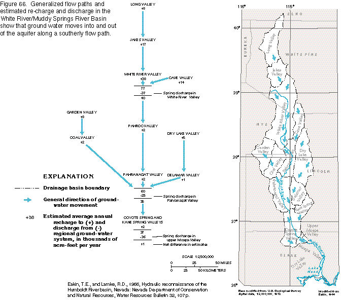
Figure 66 Map and diagram of ground-water flow, and estimated discharge
and recharge, White River/Muddy River Springs area (24K)
 editable
eps
file b066.eps.gz (50K compressed)
editable
eps
file b066.eps.gz (50K compressed)
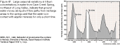
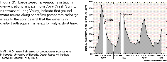
Figure 67 Graph of tritium concentration, White River/Muddy River Springs
area (10K)
 editable
eps
file b067.eps.gz (13K compressed)
editable
eps
file b067.eps.gz (13K compressed)
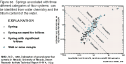
Figure 68 Graph showing springs, associated flow systems, and tritium
content (10K)
 editable eps
file b068.eps.gz (22K compressed)
editable eps
file b068.eps.gz (22K compressed)
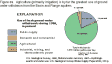
Figure 69 Diagram showing use of fresh ground water from Basin and Range
aquifers, 1985 (7K)
 editable
eps
file b069.eps.gz (11K compressed)
editable
eps
file b069.eps.gz (11K compressed)
Figure 70 Map of dissolved-solids concentrations (78K)
 editable eps
file b070.eps.gz (663K compressed)
editable eps
file b070.eps.gz (663K compressed)
 editable
eps
file b067.eps.gz (13K compressed)
editable
eps
file b067.eps.gz (13K compressed) 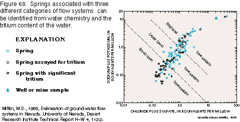 editable eps
file b068.eps.gz (22K compressed)
editable eps
file b068.eps.gz (22K compressed) 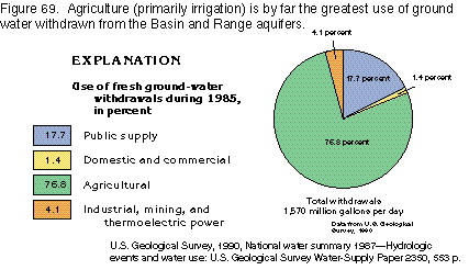 editable
eps
file b069.eps.gz (11K compressed)
editable
eps
file b069.eps.gz (11K compressed) 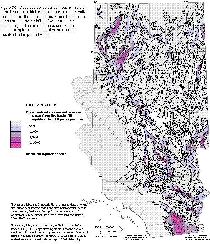 editable eps
file b070.eps.gz (663K compressed)
editable eps
file b070.eps.gz (663K compressed)