GROUND WATER ATLAS of the UNITED STATES
California, Nevada
HA 730-B
Central Valley aquifer system
There are two different files for each illustration
- A 72 ppi GIF file, suitable for screen viewing is accessed through
the thumbnail image
- An eps file, suitable for downloading to be printed or edited is accessed
through the "eps file" link. Most files are Adobe Illustrator
5.5, exceptions are noted. These files have been compressed with GNU's gzip
utility. If your web browser defaults to a screen display of the file, turn
on the "Load to local disk" option before downloading. Download
and process these eps files as ascii, not binary.
Introduction
Geologic setting
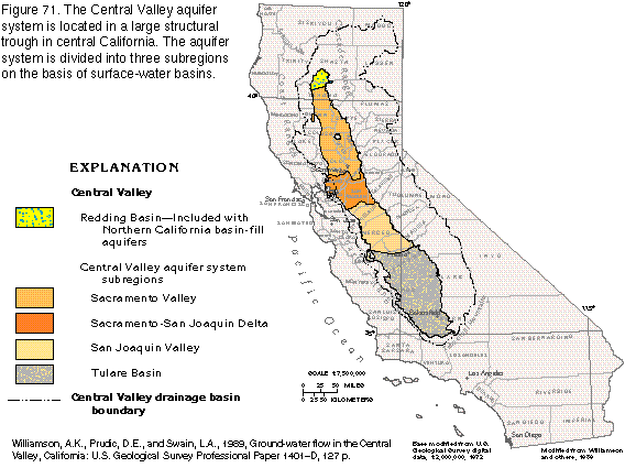
Figure 71 Map of Central Valley aquifer system (22K)
 editable eps
file b071.eps.gz (112K compressed)
editable eps
file b071.eps.gz (112K compressed)
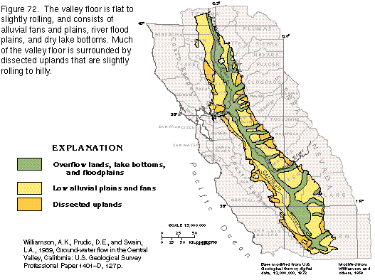
Figure 72 Map of Central Valley floor (23K)
 editable
eps
file b072.eps.gz (113K compressed)
editable
eps
file b072.eps.gz (113K compressed)
Figure 73 Map of average annual runoff (21K)
 editable eps
file b073.eps.gz (92K compressed)
editable eps
file b073.eps.gz (92K compressed)
Figure 74 Block diagram showing Central Valley geology (24K)
 This
illustration contains a placed image. Download the Adobe Illustrator 6 eps
file b074.eps.gz (181K compressed) which contains an imbedded Adobe
Photoshop 3 (eps) file. You may also want to download the editable
Photoshop file b74psh.eps.gz(180K compressed)
This
illustration contains a placed image. Download the Adobe Illustrator 6 eps
file b074.eps.gz (181K compressed) which contains an imbedded Adobe
Photoshop 3 (eps) file. You may also want to download the editable
Photoshop file b74psh.eps.gz(180K compressed)
Figure 75 Stacked maps of ancestral Central Valley, deposition of marine
rocks (19K)
 editable eps
file b075.eps.gz (262 compressed)
editable eps
file b075.eps.gz (262 compressed)
Figure 76 Map of thickness of continental deposits (22K)
 editable eps
file b076.eps.gz (87K compressed)
editable eps
file b076.eps.gz (87K compressed)
 editable
eps
file b072.eps.gz (113K compressed)
editable
eps
file b072.eps.gz (113K compressed) 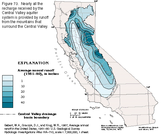 editable eps
file b073.eps.gz (92K compressed)
editable eps
file b073.eps.gz (92K compressed) 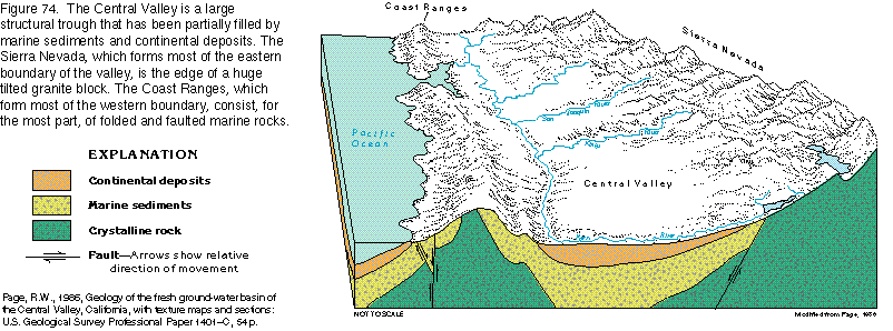 This
illustration contains a placed image. Download the Adobe Illustrator 6 eps
file b074.eps.gz (181K compressed) which contains an imbedded Adobe
Photoshop 3 (eps) file. You may also want to download the editable
Photoshop file b74psh.eps.gz(180K compressed)
This
illustration contains a placed image. Download the Adobe Illustrator 6 eps
file b074.eps.gz (181K compressed) which contains an imbedded Adobe
Photoshop 3 (eps) file. You may also want to download the editable
Photoshop file b74psh.eps.gz(180K compressed)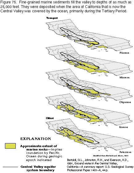 editable eps
file b075.eps.gz (262 compressed)
editable eps
file b075.eps.gz (262 compressed) 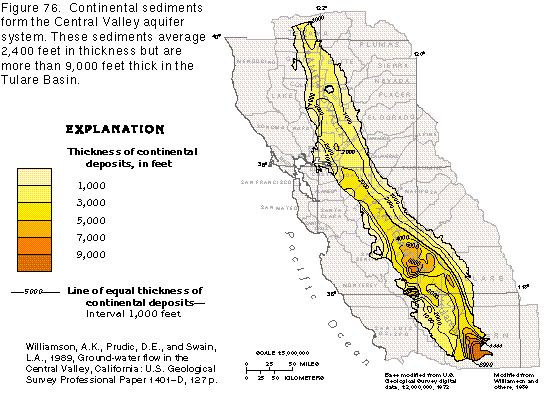 editable eps
file b076.eps.gz (87K compressed)
editable eps
file b076.eps.gz (87K compressed)