GROUND WATER ATLAS of the UNITED STATES
California, Nevada
HA 730-B
Central Valley aquifer system
There are two different files for each illustration
- A 72 ppi GIF file, suitable for screen viewing is accessed through
the thumbnail image
- An eps file, suitable for downloading to be printed or edited is accessed
through the "eps file" link. Most files are Adobe Illustrator
5.5, exceptions are noted. These files have been compressed with GNU's gzip
utility. If your web browser defaults to a screen display of the file, turn
on the "Load to local disk" option before downloading. Download
and process these eps files as ascii, not binary.
Geohydrologic setting
Ground water flow system
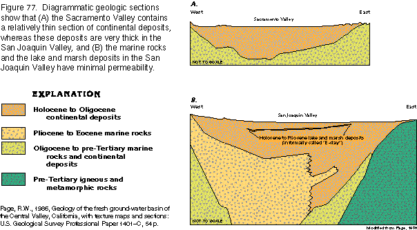
Figure 77 Diagram of Central Valley geology (23K)
 editable eps
file b077.eps.gz (46K compressed)
editable eps
file b077.eps.gz (46K compressed)
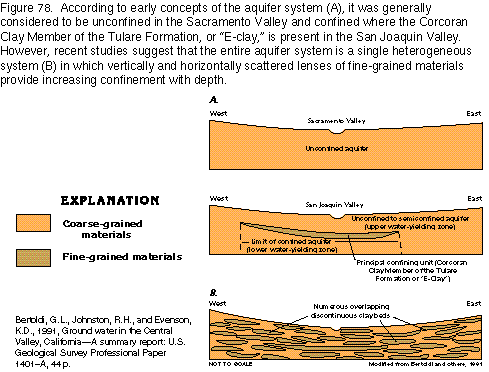
Figure 78 Diagram of concepts of the aquifer system (11K)
 editable
eps
file b078.eps.gz (22K compressed)
editable
eps
file b078.eps.gz (22K compressed)
Figure 79 Map of water table contours (21K)
 editable
eps
file b079.eps.gz (75K compressed)
editable
eps
file b079.eps.gz (75K compressed)
Figure 80 Map of recharge and discharge areas (21K)
 editable
eps
file b080.eps.gz (81K compressed)
editable
eps
file b080.eps.gz (81K compressed)
Figure 81 Diagrammatic section showing water movement (19K)
 editable eps
file b081.eps.gz (41K compressed)
editable eps
file b081.eps.gz (41K compressed)
 editable
eps
file b078.eps.gz (22K compressed)
editable
eps
file b078.eps.gz (22K compressed) 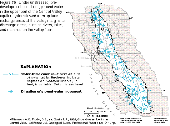 editable
eps
file b079.eps.gz (75K compressed)
editable
eps
file b079.eps.gz (75K compressed) 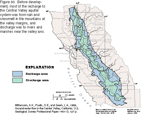 editable
eps
file b080.eps.gz (81K compressed)
editable
eps
file b080.eps.gz (81K compressed) 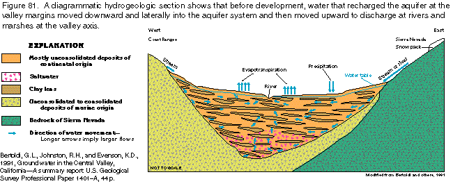 editable eps
file b081.eps.gz (41K compressed)
editable eps
file b081.eps.gz (41K compressed)