GROUND WATER ATLAS of the UNITED STATES
California, Nevada
HA 730-B
Central Valley aquifer system
There are two different files for each illustration
- A 72 ppi GIF file, suitable for screen viewing is accessed through
the thumbnail image
- An eps file, suitable for downloading to be printed or edited is accessed
through the "eps file" link. Most files are Adobe Illustrator
5.5, exceptions are noted. These files have been compressed with GNU's gzip
utility. If your web browser defaults to a screen display of the file, turn
on the "Load to local disk" option before downloading. Download
and process these eps files as ascii, not binary.
Postdevelopment ground water flow system
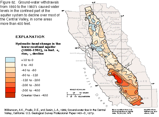
Figure 82 Map of hydraulic-head change in the lower confined aquifer, 1860-1961
(23K)
 editable eps
file b082.eps.gz (86K compressed)
editable eps
file b082.eps.gz (86K compressed)
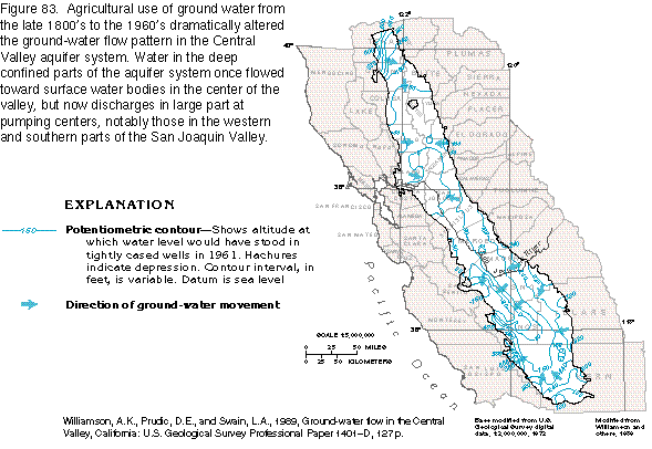
Figure 83 Map of potentiometric contours, 1961 (22K)
 editable eps
file b083.eps.gz (78K compressed)
editable eps
file b083.eps.gz (78K compressed)
Figure 84 Map of hydraulic head (22K)
 editable eps
file b084.eps.gz (83K compressed)
editable eps
file b084.eps.gz (83K compressed)
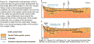
Figure 85 Diagram showing change in ground-water flow patterns(18K)
 editable
eps
file b085.eps.gz (28K compressed)
editable
eps
file b085.eps.gz (28K compressed)
Figure 86 Map showing hydraulic head change in lower confined aquifer,
1961-1976 (22K)
 editable eps
file b086.eps.gz (82K compressed)
editable eps
file b086.eps.gz (82K compressed)
Figure 87 Diagram showing change in ground water movement due to development
(11K)
 editable eps
file b087.eps.gz (15K compressed)
editable eps
file b087.eps.gz (15K compressed)
 editable eps
file b083.eps.gz (78K compressed)
editable eps
file b083.eps.gz (78K compressed) 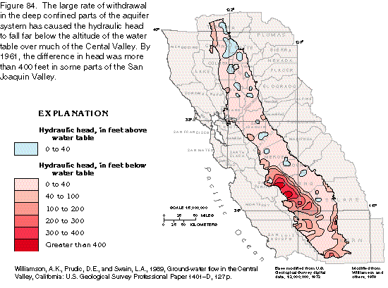 editable eps
file b084.eps.gz (83K compressed)
editable eps
file b084.eps.gz (83K compressed) 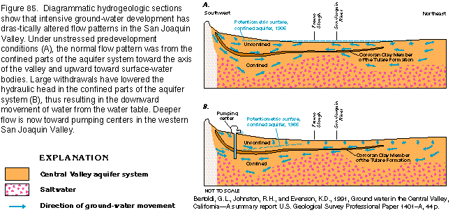 editable
eps
file b085.eps.gz (28K compressed)
editable
eps
file b085.eps.gz (28K compressed) 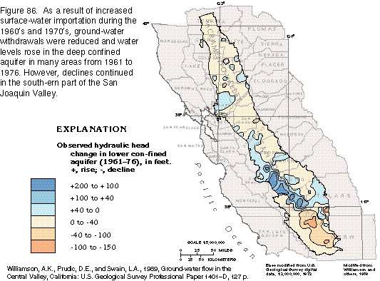 editable eps
file b086.eps.gz (82K compressed)
editable eps
file b086.eps.gz (82K compressed) 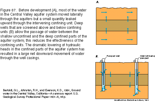 editable eps
file b087.eps.gz (15K compressed)
editable eps
file b087.eps.gz (15K compressed)