GROUND WATER ATLAS of the UNITED STATES
California, Nevada
HA 730-B
Coastal Basins aquifers
There are two different files for each illustration
- A 72 ppi GIF file, suitable for screen viewing is accessed through
the thumbnail image
- An eps file, suitable for downloading to be printed or edited is accessed
through the "eps file" link. Most files are Adobe Illustrator
5.5, exceptions are noted. These files have been compressed with GNU's gzip
utility. If your web browser defaults to a screen display of the file, turn
on the "Load to local disk" option before downloading. Download
and process these eps files as ascii, not binary.
Salinas Valley
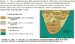
Figure 116 Map of Salinas Valley area (18K)
 editable eps
file b116.eps.gz (251K compressed)
editable eps
file b116.eps.gz (251K compressed)
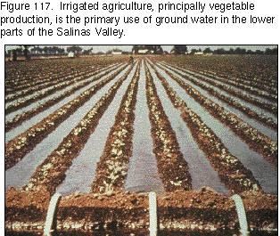
Figure 117 Photograph of irrigated agricultural field (75K)
 This illustration contains a placed image. Download the Adobe Illustrator
6 eps
file b117.eps.gz (5.2M compressed) which contains an imbedded Adobe
Photoshop 3 (eps) file. You may also want to download the editable
Photoshop file b117psh.eps.gz(5.2M compressed)
This illustration contains a placed image. Download the Adobe Illustrator
6 eps
file b117.eps.gz (5.2M compressed) which contains an imbedded Adobe
Photoshop 3 (eps) file. You may also want to download the editable
Photoshop file b117psh.eps.gz(5.2M compressed)
Figure 118 Map of Salinas Valley continental deposits (27K)
 editable eps
file b118.eps.gz (483K compressed)
editable eps
file b118.eps.gz (483K compressed)
Figure 119 Diagrammatic hydrogeologic section (17K)
 editable
eps
file b119.eps.gz (241K compressed)
editable
eps
file b119.eps.gz (241K compressed)
Figure 120 Diagrammatic hydrogeologic section illustrating interbedded
aquifers and confining units (12K)
 editable
eps
file b120.eps.gz (310K compressed)
editable
eps
file b120.eps.gz (310K compressed)
Figure 121 Map of water-table contours (23K)
 editable
eps
file b121.eps.gz (76K compressed)
editable
eps
file b121.eps.gz (76K compressed)
Figure 122 Map of ground-water contamination areas (21K)
 editable
eps
file b122.eps.gz (70K compressed)
editable
eps
file b122.eps.gz (70K compressed)

 This illustration contains a placed image. Download the Adobe Illustrator
6 eps
file b117.eps.gz (5.2M compressed) which contains an imbedded Adobe
Photoshop 3 (eps) file. You may also want to download the editable
Photoshop file b117psh.eps.gz(5.2M compressed)
This illustration contains a placed image. Download the Adobe Illustrator
6 eps
file b117.eps.gz (5.2M compressed) which contains an imbedded Adobe
Photoshop 3 (eps) file. You may also want to download the editable
Photoshop file b117psh.eps.gz(5.2M compressed)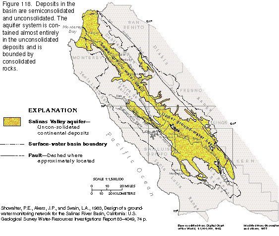 editable eps
file b118.eps.gz (483K compressed)
editable eps
file b118.eps.gz (483K compressed) 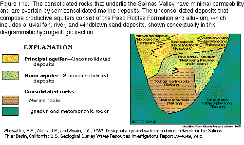 editable
eps
file b119.eps.gz (241K compressed)
editable
eps
file b119.eps.gz (241K compressed) 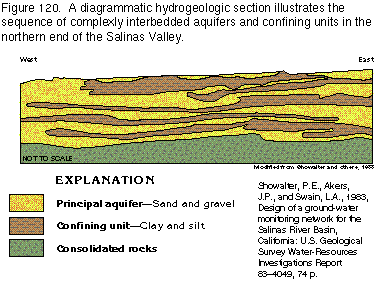 editable
eps
file b120.eps.gz (310K compressed)
editable
eps
file b120.eps.gz (310K compressed) 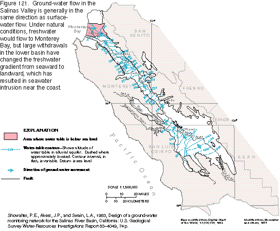 editable
eps
file b121.eps.gz (76K compressed)
editable
eps
file b121.eps.gz (76K compressed) 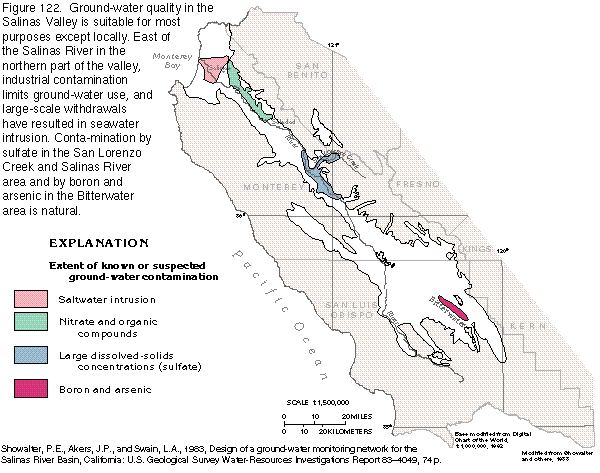 editable
eps
file b122.eps.gz (70K compressed)
editable
eps
file b122.eps.gz (70K compressed)