GROUND WATER ATLAS of the UNITED STATES
California, Nevada
HA 730-B
Regional summary
There are two different files for each illustration
- A 72 ppi GIF file, suitable for screen viewing is accessed through
the thumbnail image
- An eps file, suitable for downloading to be printed or edited is accessed
through the "eps file" link. Most files are Adobe Illustrator
5.5, exceptions are noted. These files have been compressed with GNU's gzip
utility. If your web browser defaults to a screen display of the file, turn
on the "Load to local disk" option before downloading. Download
and process these eps files as ascii, not binary.
Water Surplus and Deficit
Physiography and Land Use
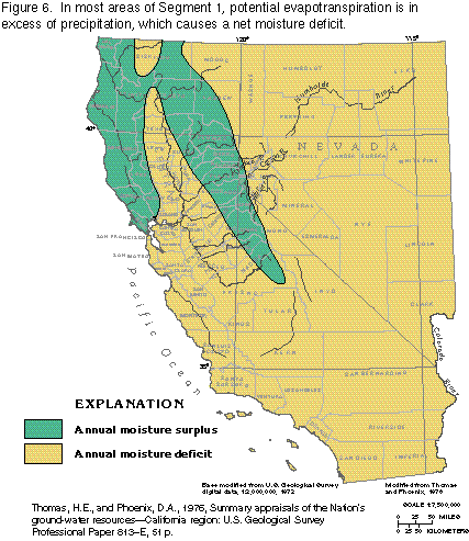
Figure 6 Map of annual moisture surplus and deficit areas (25K)
 editable
eps
file b006.eps (69K compressed)
editable
eps
file b006.eps (69K compressed)
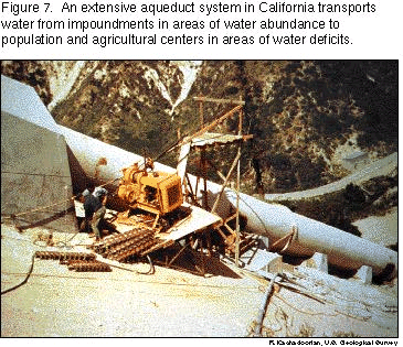
Figure 7 Photograph of aqueduct (96K)
 This
illustration contains a placed image. Download the Adobe Illustrator 6 eps
file b007.eps (7.2M compressed) which contains an imbedded Adobe Photoshop
3 (eps) file. You may also want to download the editable
Photoshop file b07psh.eps.gz(7.2M compressed)
This
illustration contains a placed image. Download the Adobe Illustrator 6 eps
file b007.eps (7.2M compressed) which contains an imbedded Adobe Photoshop
3 (eps) file. You may also want to download the editable
Photoshop file b07psh.eps.gz(7.2M compressed)
Figure 8 Map of physiographic provinces (22K)
 editable
eps
file b008.eps (60K compressed)
editable
eps
file b008.eps (60K compressed)
Figure 9 Shaded relief image (49K)
 This
illustration contains a placed image. Download the Adobe Illustrator 6 eps
file b009.eps (1.6M compressed) which contains an imbedded Adobe Photoshop
3 (eps) file. You may also want to download the editable
Photoshop file b09psh.eps.gz(1.6M compressed)
This
illustration contains a placed image. Download the Adobe Illustrator 6 eps
file b009.eps (1.6M compressed) which contains an imbedded Adobe Photoshop
3 (eps) file. You may also want to download the editable
Photoshop file b09psh.eps.gz(1.6M compressed)
Figure 10 Map of landuse (37K)
 editable
eps
file b010.eps (151K compressed)
editable
eps
file b010.eps (151K compressed)
 This
illustration contains a placed image. Download the Adobe Illustrator 6 eps
file b007.eps (7.2M compressed) which contains an imbedded Adobe Photoshop
3 (eps) file. You may also want to download the editable
Photoshop file b07psh.eps.gz(7.2M compressed)
This
illustration contains a placed image. Download the Adobe Illustrator 6 eps
file b007.eps (7.2M compressed) which contains an imbedded Adobe Photoshop
3 (eps) file. You may also want to download the editable
Photoshop file b07psh.eps.gz(7.2M compressed) 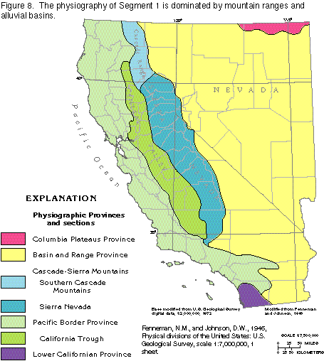 editable
eps
file b008.eps (60K compressed)
editable
eps
file b008.eps (60K compressed) 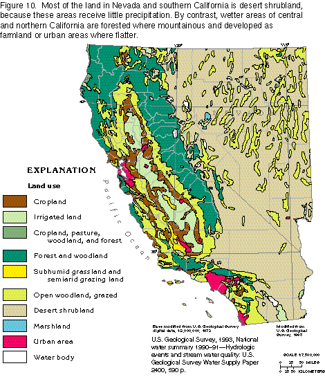 editable
eps
file b010.eps (151K compressed)
editable
eps
file b010.eps (151K compressed)