GROUND WATER ATLAS of the UNITED STATES
Arizona, Colorado, New Mexico, Utah
HA 730-C
Denver Basin aquifer system
There are two different files for each illustration
- A 90 ppi JPEG file, suitable for screen viewing is accessed
through the thumbnail image.
- A tiff file is accessed through the "tiff file"
link. All files are Adobe Photoshop. These files have been compressed
with GNU's gzip utility. If your web browser defaults to a screen
display of the file, turn on the "Load to local disk"
option before downloading. Download and process these tiff files
as ascii, not binary.
Water-level Conditions
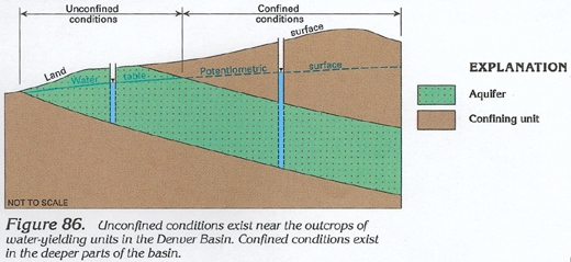
Figure 86 Diagram showing the unconfined and confined conditions
of the Denver Basin (136K)
 downloadable tiff file C086.tif.gz
(1.1MB compressed)
downloadable tiff file C086.tif.gz
(1.1MB compressed)
Figure 87 Maps showing potentiometric surfaces
of the four Denver Basin aquifers and water-level changes from
1958 to 1978 (188K)
 downloadable tiff file C087.tif.gz
(3.4MB compressed)
downloadable tiff file C087.tif.gz
(3.4MB compressed)
Figure 88 Graph showing water level changes in
the Arapahoe aquifer from 1884 to present (112K)
 downloadable tiff file C088.tif.gz
(887K compressed)
downloadable tiff file C088.tif.gz
(887K compressed)
 downloadable tiff file C086.tif.gz
(1.1MB compressed)
downloadable tiff file C086.tif.gz
(1.1MB compressed) 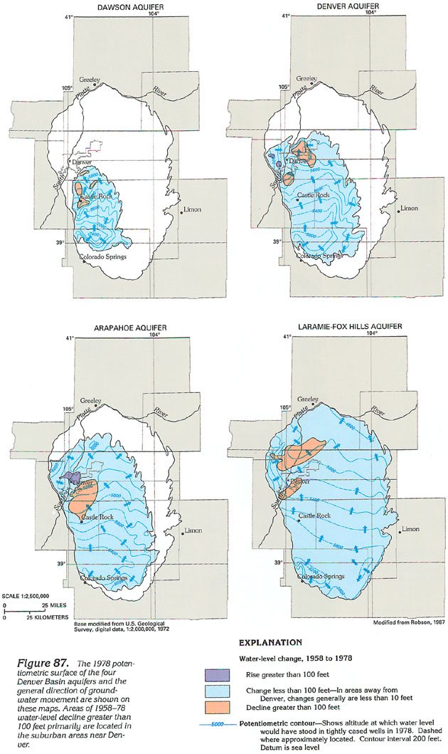 downloadable tiff file C087.tif.gz
(3.4MB compressed)
downloadable tiff file C087.tif.gz
(3.4MB compressed) 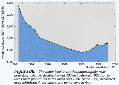 downloadable tiff file C088.tif.gz
(887K compressed)
downloadable tiff file C088.tif.gz
(887K compressed)