GROUND WATER ATLAS of the UNITED STATES
Arizona, Colorado, New Mexico, Utah
HA 730-C
High Plains aquifer
There are two different files for each illustration
- A 90 ppi JPEG file, suitable for screen viewing is accessed
through the thumbnail image.
- A tiff file is accessed through the "tiff file"
link. All files are Adobe Photoshop. These files have been compressed
with GNU's gzip utility. If your web browser defaults to a screen
display of the file, turn on the "Load to local disk"
option before downloading. Download and process these tiff files
as ascii, not binary.
Hydrogeologic Units
Figure 67 Correlation chart showing geologic composition
of the High Plains aquifer (128K)
 downloadable tiff file C067.tif.gz (793K
compressed)
downloadable tiff file C067.tif.gz (793K
compressed)
Figure 68 Map showing geologic units of
the High Plains aquifer (160K)
 downloadable tiff file C068.tif.gz (1.2MB
compressed)
downloadable tiff file C068.tif.gz (1.2MB
compressed)
Figure 69 Photograph of the Mescalero Escarpment
(228K)
 downloadable tiff file C069.tif.gz (1.8MB
compressed)
downloadable tiff file C069.tif.gz (1.8MB
compressed)
Figure 70 Map showing geologic units that
underlie the High Plains aquifer (152K)
 downloadable tiff file C070.tif.gz (1.1MB
compressed)
downloadable tiff file C070.tif.gz (1.1MB
compressed)
Figure 71 Cross section showing the varying
thickness of the High Plains aquifer in northeastern Colorado
(188K)
 downloadable tiff file C071.tif.gz (1.4MB
compressed)
downloadable tiff file C071.tif.gz (1.4MB
compressed)
 downloadable tiff file C067.tif.gz (793K
compressed)
downloadable tiff file C067.tif.gz (793K
compressed) 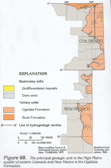 downloadable tiff file C068.tif.gz (1.2MB
compressed)
downloadable tiff file C068.tif.gz (1.2MB
compressed) 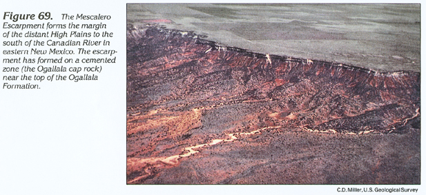 downloadable tiff file C069.tif.gz (1.8MB
compressed)
downloadable tiff file C069.tif.gz (1.8MB
compressed) 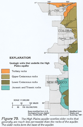 downloadable tiff file C070.tif.gz (1.1MB
compressed)
downloadable tiff file C070.tif.gz (1.1MB
compressed) 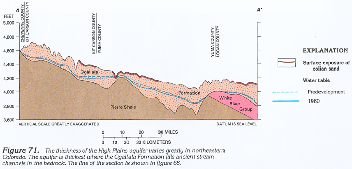 downloadable tiff file C071.tif.gz (1.4MB
compressed)
downloadable tiff file C071.tif.gz (1.4MB
compressed)