GROUND WATER ATLAS of the UNITED STATES
Arizona, Colorado, New Mexico, Utah
HA 730-C
High Plains aquifer
There are two different files for each illustration
- A 90 ppi JPEG file, suitable for screen viewing is accessed
through the thumbnail image.
- A tiff file is accessed through the "tiff file"
link. All files are Adobe Photoshop. These files have been compressed
with GNU's gzip utility. If your web browser defaults to a screen
display of the file, turn on the "Load to local disk"
option before downloading. Download and process these tiff files
as ascii, not binary.
Water-level Conditions
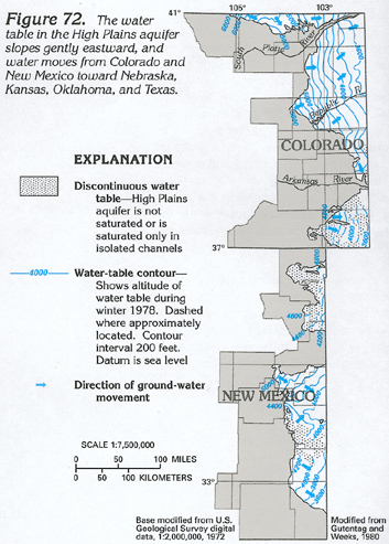
Figure 72 Map showing the water-table contours in the High
Plains aquifer (184K)
 downloadable tiff file C072.tif.gz (1.2MB
compressed)
downloadable tiff file C072.tif.gz (1.2MB
compressed)
Figure 73 Map showing depth to water in
the High Plains aquifer (140K)
 downloadable tiff file C073.tif.gz (1MB
compressed)
downloadable tiff file C073.tif.gz (1MB
compressed)
Figure 74 Map showing water-level declines
from predevelopment to 1980 in the High Plains aquifer (204K)
 downloadable tiff file C074.tif.gz (1.6MB
compressed)
downloadable tiff file C074.tif.gz (1.6MB
compressed)
Figure 75 Map showing saturated thickness
of the High Plains aquifer (148K)
 downloadable tiff file C075.tif.gz (1.2MB
compressed)
downloadable tiff file C075.tif.gz (1.2MB
compressed)
 downloadable tiff file C072.tif.gz (1.2MB
compressed)
downloadable tiff file C072.tif.gz (1.2MB
compressed) 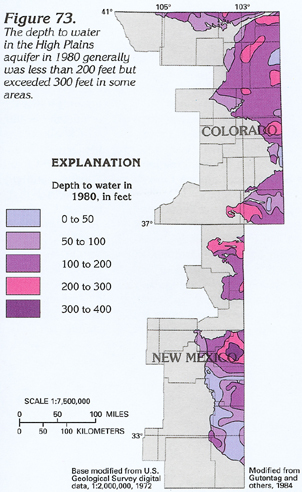 downloadable tiff file C073.tif.gz (1MB
compressed)
downloadable tiff file C073.tif.gz (1MB
compressed) 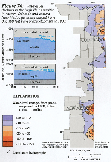 downloadable tiff file C074.tif.gz (1.6MB
compressed)
downloadable tiff file C074.tif.gz (1.6MB
compressed) 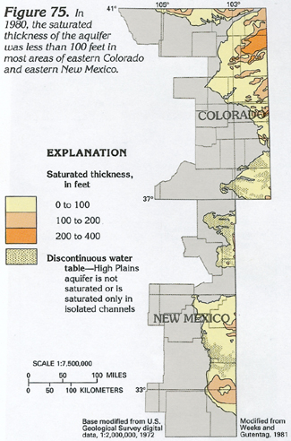 downloadable tiff file C075.tif.gz (1.2MB
compressed)
downloadable tiff file C075.tif.gz (1.2MB
compressed)