GROUND WATER ATLAS of the UNITED STATES
Arizona, Colorado, New Mexico, Utah
HA 730-C

High Plains aquifer


There are two different files for each illustration

A 90 ppi JPEG file, suitable for screen viewing is accessed through the thumbnail image.

A tiff file is accessed through the "tiff file" link. All files are Adobe Photoshop. These files have been compressed with GNU's gzip utility. If your web browser defaults to a screen display of the file, turn on the "Load to local disk" option before downloading. Download and process these tiff files as ascii, not binary.


Fresh Ground-water Withdrawals


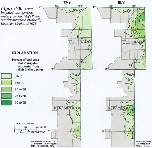
Figure 78 Map showing the increased percentage of land area irrigated with ground water from the High Plains aquifer between 1949 and 1978 (212K)
downloadable tiff file C078.tif.gz (1.8MB compressed)


Return to High Plains aquifer text
Return to HA 730-C table of contents
Return to Ground Water Atlas home page