GROUND WATER ATLAS of the UNITED STATES
Arizona, Colorado, New Mexico, Utah
HA 730-C

Roswell Basin aquifer system


There are two different files for each illustration

A 90 ppi JPEG file, suitable for screen viewing is accessed through the thumbnail image.

A tiff file is accessed through the "tiff file" link. All files are Adobe Photoshop. These files have been compressed with GNU's gzip utility. If your web browser defaults to a screen display of the file, turn on the "Load to local disk" option before downloading. Download and process these tiff files as ascii, not binary.


Recharge and Discharge


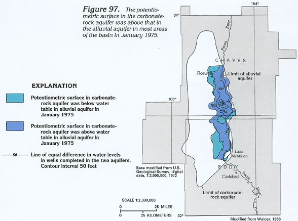
Figure 97 Map showing the comparison of the potentiometric surface of the carbonate-rock aquifer to that of the alluvial aquifer in January, 1975 (192K)
downloadable tiff file C097.tif.gz (1.5MB compressed)


Return to Roswell Basin aquifer system text
Return to HA 730-C table of contents
Return to Ground Water Atlas home page