GROUND WATER ATLAS of the UNITED STATES
Arizona, Colorado, New Mexico, Utah
HA 730-C
Roswell Basin aquifer system
There are two different files for each illustration
- A 90 ppi JPEG file, suitable for screen viewing is accessed
through the thumbnail image.
- A tiff file is accessed through the "tiff file"
link. All files are Adobe Photoshop. These files have been compressed
with GNU's gzip utility. If your web browser defaults to a screen
display of the file, turn on the "Load to local disk"
option before downloading. Download and process these tiff files
as ascii, not binary.
Water-level Conditions
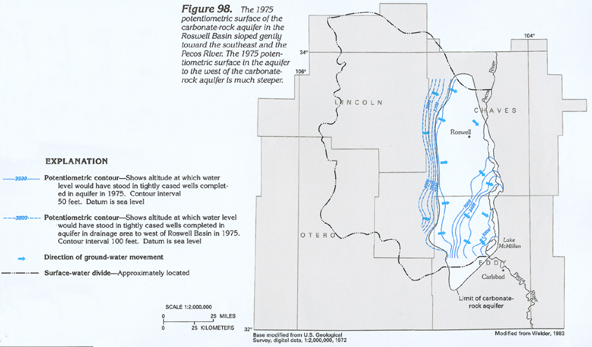
Figure 98 Map showing the potentiometric surface of the
carbonate-rock aquifer in the Roswell Basin (194K)
 downloadable tiff file C098.tif.gz
(2.3MB compressed)
downloadable tiff file C098.tif.gz
(2.3MB compressed)
Figure 99 Map showing the potentiometric
surface of the alluvial aquifer in the Roswell Basin (194K)
 downloadable tiff file C099.tif.gz
(1.5MB compressed)
downloadable tiff file C099.tif.gz
(1.5MB compressed)
Figure 100 Photograph of flowing well completed
in the carbonate-rock aquifer near Roswell, New Mexico (194K)
 downloadable tiff file C100.tif.gz
(1.4MB compressed)
downloadable tiff file C100.tif.gz
(1.4MB compressed)
Figure 101 Map showing water-level decline
in the carbonate-rock aquifer from 1950 to 1975 (194K)
 downloadable tiff file C101.tif.gz
(1.4MB compressed)
downloadable tiff file C101.tif.gz
(1.4MB compressed)
Figure 102 Map showing water-level decline
in the alluvial aquifer from 1950 to 1975 (194K)
 downloadable tiff file C102.tif.gz
(1.3MB compressed)
downloadable tiff file C102.tif.gz
(1.3MB compressed)
 downloadable tiff file C098.tif.gz
(2.3MB compressed)
downloadable tiff file C098.tif.gz
(2.3MB compressed) 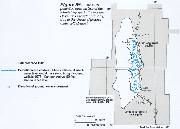 downloadable tiff file C099.tif.gz
(1.5MB compressed)
downloadable tiff file C099.tif.gz
(1.5MB compressed) 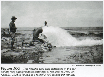 downloadable tiff file C100.tif.gz
(1.4MB compressed)
downloadable tiff file C100.tif.gz
(1.4MB compressed) 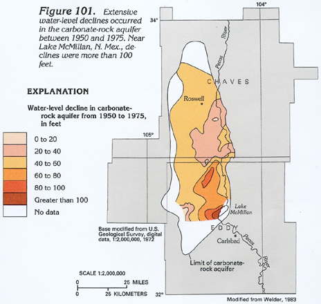 downloadable tiff file C101.tif.gz
(1.4MB compressed)
downloadable tiff file C101.tif.gz
(1.4MB compressed) 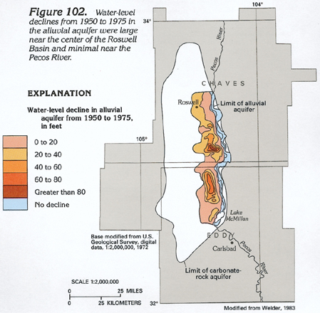 downloadable tiff file C102.tif.gz
(1.3MB compressed)
downloadable tiff file C102.tif.gz
(1.3MB compressed)