GROUND WATER ATLAS of the UNITED STATES
Arizona, Colorado, New Mexico, Utah
HA 730-C
Basin and Range aquifers
There are two different files for each illustration
- A 90 ppi JPEG file, suitable for screen viewing is accessed
through the thumbnail image.
- A tiff file is accessed through the "tiff file"
link. All files are Adobe Photoshop. These files have been compressed
with GNU's gzip utility. If your web browser defaults to a screen
display of the file, turn on the "Load to local disk"
option before downloading. Download and process these tiff files
as ascii, not binary.
Hydrogeologic Units
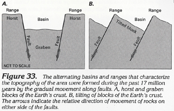
Figure 33 Diagram showing the formation of the alternating
basin and range topography (92K)
 downloadable tiff file C033.tif.gz
(648K compressed)
downloadable tiff file C033.tif.gz
(648K compressed)
Figure 34 Diagram showing the location and
composition of basin fill (96K)
 downloadable tiff file C034.tif.gz
(757K compressed)
downloadable tiff file C034.tif.gz
(757K compressed)
Figure 35 Map showing the four principal
hydrogeologic units of the Basin and Range aquifers (232K)
 downloadable tiff file C035.tif.gz
(3.3MB compressed)
downloadable tiff file C035.tif.gz
(3.3MB compressed)
Figure 36 Map showing the location of the
remnants of Lake Bonneville that existed during the great ice
age in Utah (172K)
 downloadable tiff file C036.tif.gz
(1.3MB compressed)
downloadable tiff file C036.tif.gz
(1.3MB compressed)
 downloadable tiff file C033.tif.gz
(648K compressed)
downloadable tiff file C033.tif.gz
(648K compressed) 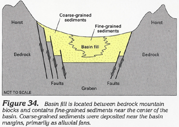 downloadable tiff file C034.tif.gz
(757K compressed)
downloadable tiff file C034.tif.gz
(757K compressed) 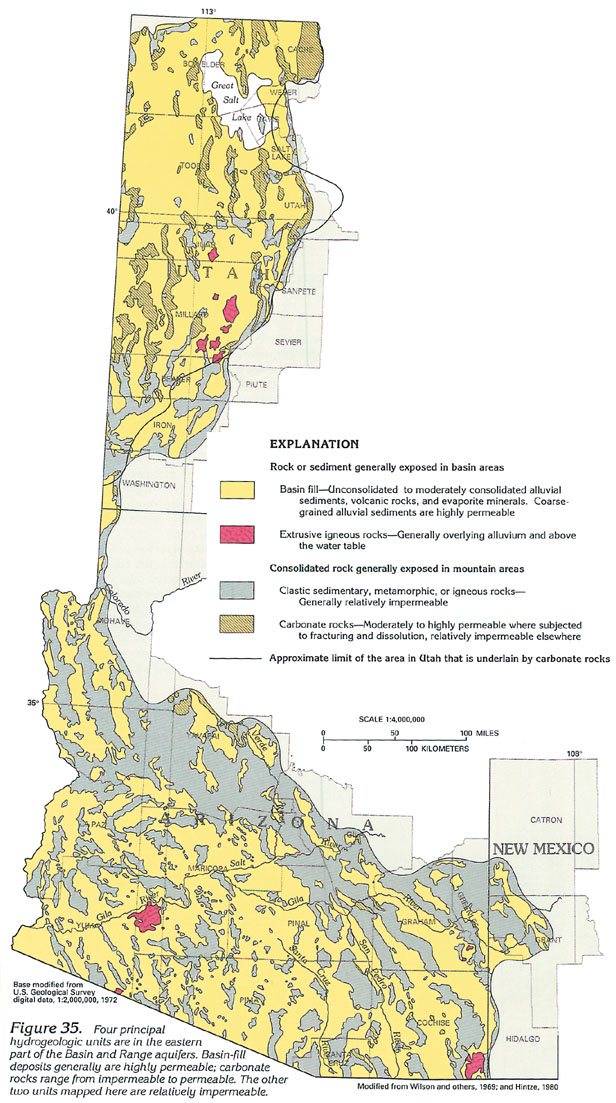 downloadable tiff file C035.tif.gz
(3.3MB compressed)
downloadable tiff file C035.tif.gz
(3.3MB compressed) 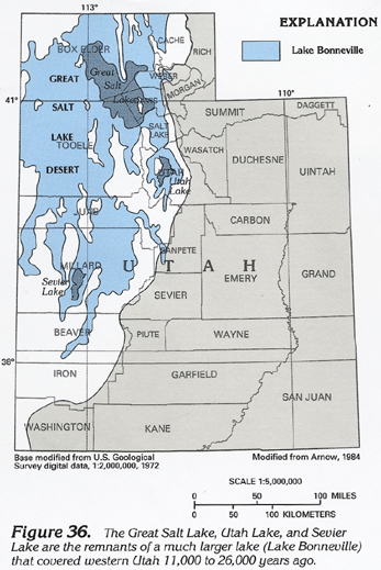 downloadable tiff file C036.tif.gz
(1.3MB compressed)
downloadable tiff file C036.tif.gz
(1.3MB compressed)