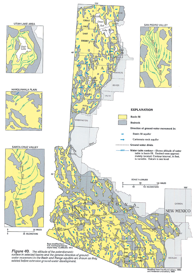
Figure 40 Map showing the altitude of the potentiometric surface and general direction of ground-water movement in the Basin and Range aquifers before ground-water development (304K)
 downloadable tiff file C040.tif.gz
(4.7MB compressed)
downloadable tiff file C040.tif.gz
(4.7MB compressed)
Figure 40 Map showing the altitude of the potentiometric
surface and general direction of ground-water movement in the
Basin and Range aquifers before ground-water development (304K)
downloadable tiff file C040.tif.gz
(4.7MB compressed)
 downloadable tiff file C041.tif.gz
(1.8MB compressed)
downloadable tiff file C041.tif.gz
(1.8MB compressed)  downloadable tiff file C042.tif.gz
(1.9MB compressed)
downloadable tiff file C042.tif.gz
(1.9MB compressed) downloadable tiff file C043.tif.gz
(4.9MB compressed)
downloadable tiff file C043.tif.gz
(4.9MB compressed)