GROUND WATER ATLAS of the UNITED STATES
Arizona, Colorado, New Mexico, Utah
HA 730-C
Basin and Range aquifers
There are two different files for each illustration
- A 90 ppi JPEG file, suitable for screen viewing is accessed
through the thumbnail image.
A tiff file is accessed through the "tiff file" link.
All files are Adobe Photoshop. These files have been compressed
with GNU's gzip utility. If your web browser defaults to a screen
display of the file, turn on the "Load to local disk"
option before downloading. Download and process these tiff files
as ascii, not binary.
Effects of Withdrawals
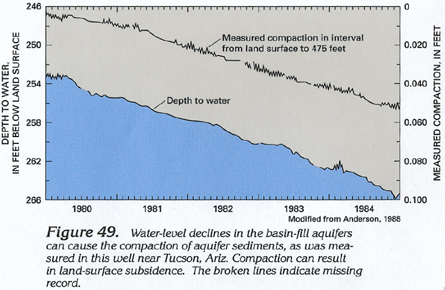
Figure 49 Graph showing that water level decline in
the basin-fill aquifers can cause the compaction of aquifer sediments
(132K)
 downloadable tiff file C049.tif.gz (1MB
compressed)
downloadable tiff file C049.tif.gz (1MB
compressed)
Figure 50 Photograph showing earth fissures
caused by compaction and subsidence (120K)
 downloadable tiff file C050.tif.gz (516K
compressed)
downloadable tiff file C050.tif.gz (516K
compressed)
Figure 51 Photograph showing earth fissures
enlarged by erosion (120K)
 downloadable tiff file C051.tif.gz (530K
compressed)
downloadable tiff file C051.tif.gz (530K
compressed)
 downloadable tiff file C049.tif.gz (1MB
compressed)
downloadable tiff file C049.tif.gz (1MB
compressed) 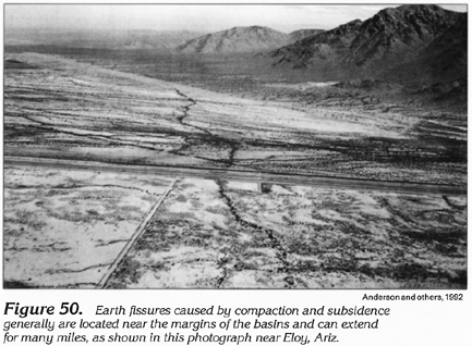 downloadable tiff file C050.tif.gz (516K
compressed)
downloadable tiff file C050.tif.gz (516K
compressed) 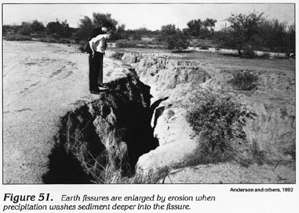 downloadable tiff file C051.tif.gz (530K
compressed)
downloadable tiff file C051.tif.gz (530K
compressed)