GROUND WATER ATLAS of the UNITED STATES
Arizona, Colorado, New Mexico, Utah
HA 730-C
Regional summary
There are two different files for each illustration
- A 90 ppi JPEG file, suitable for screen viewing is accessed
through the thumbnail image.
- A tiff file is accessed through the "tiff file"
link. All files are Adobe Photoshop. These files have been compressed
with GNU's gzip utility. If your web browser defaults to a screen
display of the file, turn on the "Load to local disk"
option before downloading. Download and process these tiff files
as ascii, not binary.
Introduction
Figure 1 Map showing the six physiographic provinces of
Segment 2 (432K)
 downloadable tiff file C001.tif.gz (4MB
compressed)
downloadable tiff file C001.tif.gz (4MB
compressed)
Figure 2 Photograph showing the Great Plains
of eastern Colorado (188K)
 downloadable tiff file C002.tif.gz (1.5MB
compressed)
downloadable tiff file C002.tif.gz (1.5MB
compressed)
Figure 3 Photograph showing the Rocky Mountains (208K)
 downloadable tiff file C003.tif.gz (1.6MB
compressed)
downloadable tiff file C003.tif.gz (1.6MB
compressed)
Figure 4 Photograph showing the Colorado
River in western Colorado (204K)
 downloadable tiff file C004.tif.gz (1.6MB
compressed)
downloadable tiff file C004.tif.gz (1.6MB
compressed)
Figure 5 Photograph showing canyons in southern
Utah (208K)
 downloadable tiff file C005.tif.gz (1.6MB
compressed)
downloadable tiff file C005.tif.gz (1.6MB
compressed)
Figure 6 Photograph showing desert valleys of southern
Arizona (212K)
 downloadable tiff file C006.tif.gz (1.6MB
compressed)
downloadable tiff file C006.tif.gz (1.6MB
compressed)
Figure 7 Map showing population density
(424K)
 downloadable tiff file C007.tif.gz (4.2MB
compressed)
downloadable tiff file C007.tif.gz (4.2MB
compressed)
 downloadable tiff file C001.tif.gz (4MB
compressed)
downloadable tiff file C001.tif.gz (4MB
compressed) 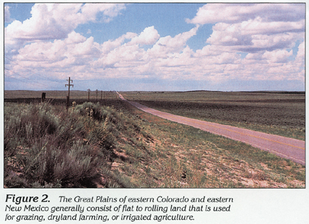 downloadable tiff file C002.tif.gz (1.5MB
compressed)
downloadable tiff file C002.tif.gz (1.5MB
compressed) 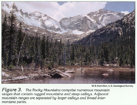 downloadable tiff file C003.tif.gz (1.6MB
compressed)
downloadable tiff file C003.tif.gz (1.6MB
compressed) 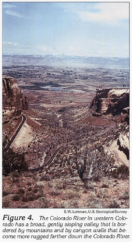 downloadable tiff file C004.tif.gz (1.6MB
compressed)
downloadable tiff file C004.tif.gz (1.6MB
compressed) 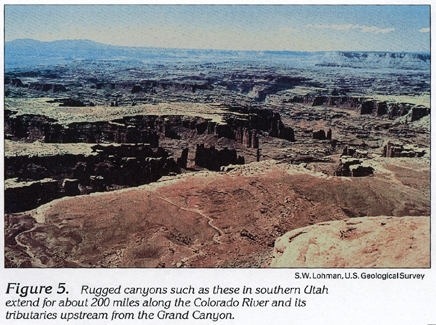 downloadable tiff file C005.tif.gz (1.6MB
compressed)
downloadable tiff file C005.tif.gz (1.6MB
compressed) 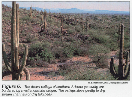 downloadable tiff file C006.tif.gz (1.6MB
compressed)
downloadable tiff file C006.tif.gz (1.6MB
compressed) 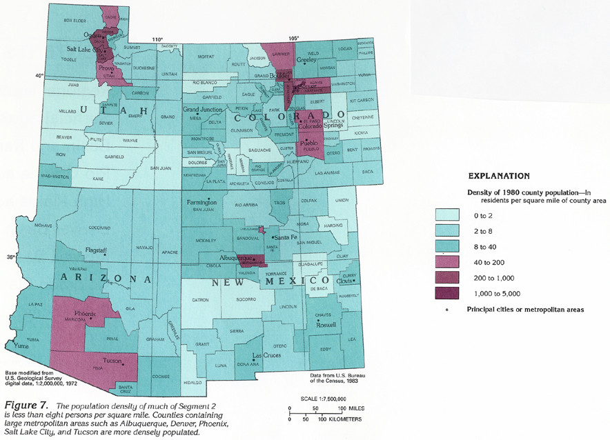 downloadable tiff file C007.tif.gz (4.2MB
compressed)
downloadable tiff file C007.tif.gz (4.2MB
compressed)