GROUND WATER ATLAS of the UNITED STATES
Arizona, Colorado, New Mexico, Utah
HA 730-C
Regional summary
There are two different files for each illustration
- A 90 ppi JPEG file, suitable for screen viewing is accessed
through the thumbnail image.
- A tiff file is accessed through the "tiff file"
link. All files are Adobe Photoshop. These files have been compressed
with GNU's gzip utility. If your web browser defaults to a screen
display of the file, turn on the "Load to local disk"
option before downloading. Download and process these tiff files
as ascii, not binary.
Fresh Ground-water Withdrawals
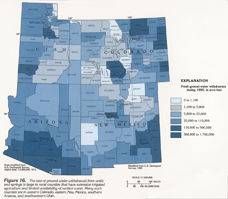
Figure 16 Map showing rate of fresh ground-water withdrawal
from wells and springs in Segment 2 (424K)
 downloadable tiff file C016.tif.gz (4.2MB
compressed)
downloadable tiff file C016.tif.gz (4.2MB
compressed)
Figure 17 Map showing ground-water usage in each county
of Segment 2 (544K)
 downloadable tiff file C017.tif.gz (5.6MB
compressed)
downloadable tiff file C017.tif.gz (5.6MB
compressed)
 downloadable tiff file C016.tif.gz (4.2MB
compressed)
downloadable tiff file C016.tif.gz (4.2MB
compressed) 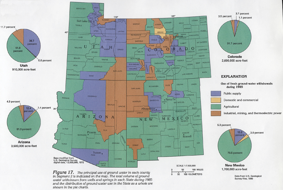 downloadable tiff file C017.tif.gz (5.6MB
compressed)
downloadable tiff file C017.tif.gz (5.6MB
compressed)