GROUND WATER ATLAS of the UNITED STATES
Arizona, Colorado, New Mexico, Utah
HA 730-C
Surficial aquifers
There are two different files for each illustration
- A 90 ppi JPEG file, suitable for screen viewing is accessed
through the thumbnail image.
- A tiff file is accessed through the "tiff file"
link. All files are Adobe Photoshop. These files have been compressed
with GNU's gzip utility. If your web browser defaults to a screen
display of the file, turn on the "Load to local disk"
option before downloading. Download and process these tiff files
as ascii, not binary.
Introduction
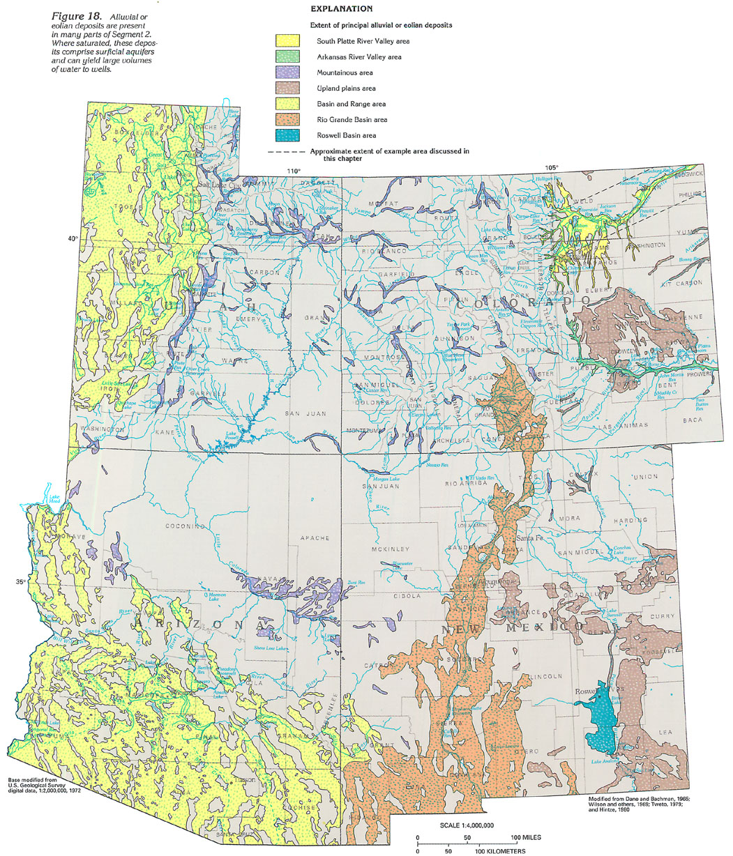
Figure 18 Map showing the extent of principal alluvial
or eolian deposits (596K)
 downloadable tiff file C018.tif.gz
(9.3MB compressed)
downloadable tiff file C018.tif.gz
(9.3MB compressed)
Figure 19 Photograph showing the valley
of the South Platte River near Fort Lupton, Colorado (192K)
 downloadable tiff file C019.tif.gz
(1.6MB compressed)
downloadable tiff file C019.tif.gz
(1.6MB compressed)
Figure 20 Photograph showing the South Platte River on
the plains of eastern Colorado (168K)
 downloadable tiff file C020.tif.gz
(1.4MB compressed)
downloadable tiff file C020.tif.gz
(1.4MB compressed)
Figure 21 Diagram showing the alluvium composition
from the Continental Divide to the Great Plains (140K)
 downloadable tiff file C021.tif.gz
(1.1MB compressed)
downloadable tiff file C021.tif.gz
(1.1MB compressed)
 downloadable tiff file C018.tif.gz
(9.3MB compressed)
downloadable tiff file C018.tif.gz
(9.3MB compressed) 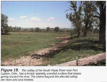 downloadable tiff file C019.tif.gz
(1.6MB compressed)
downloadable tiff file C019.tif.gz
(1.6MB compressed) 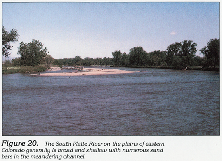 downloadable tiff file C020.tif.gz
(1.4MB compressed)
downloadable tiff file C020.tif.gz
(1.4MB compressed) 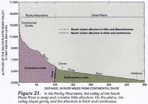 downloadable tiff file C021.tif.gz
(1.1MB compressed)
downloadable tiff file C021.tif.gz
(1.1MB compressed)