GROUND WATER ATLAS of the UNITED STATES
Arizona, Colorado, New Mexico, Utah
HA 730-C
Surficial aquifers
There are two different files for each illustration
- A 90 ppi JPEG file, suitable for screen viewing is accessed
through the thumbnail image.
- A tiff file is accessed through the "tiff file"
link. All files are Adobe Photoshop. These files have been compressed
with GNU's gzip utility. If your web browser defaults to a screen
display of the file, turn on the "Load to local disk"
option before downloading. Download and process these tiff files
as ascii, not binary.
Water-level Conditions
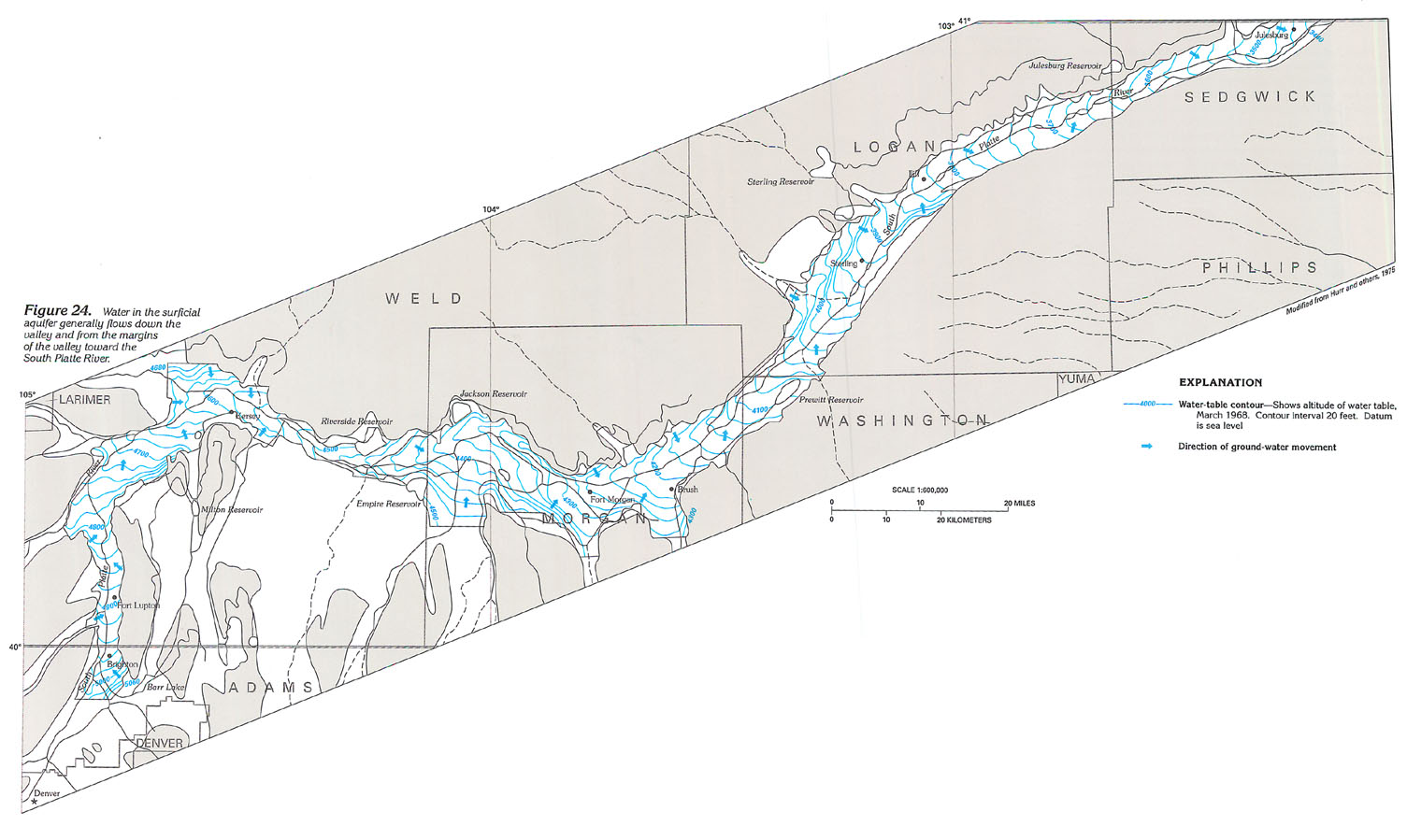
Figure 24 Map showing the direction of ground-water movement
in the South Platte River area (228K)
 downloadable tiff file C024.tif.gz
(4.1MB compressed)
downloadable tiff file C024.tif.gz
(4.1MB compressed)
Figure 25 Map and graphs showing water level
change in the surficial aquifer from 1947 to 1970 (248K)
 downloadable tiff file C025.tif.gz
(5.8MB compressed)
downloadable tiff file C025.tif.gz
(5.8MB compressed)
 downloadable tiff file C024.tif.gz
(4.1MB compressed)
downloadable tiff file C024.tif.gz
(4.1MB compressed) 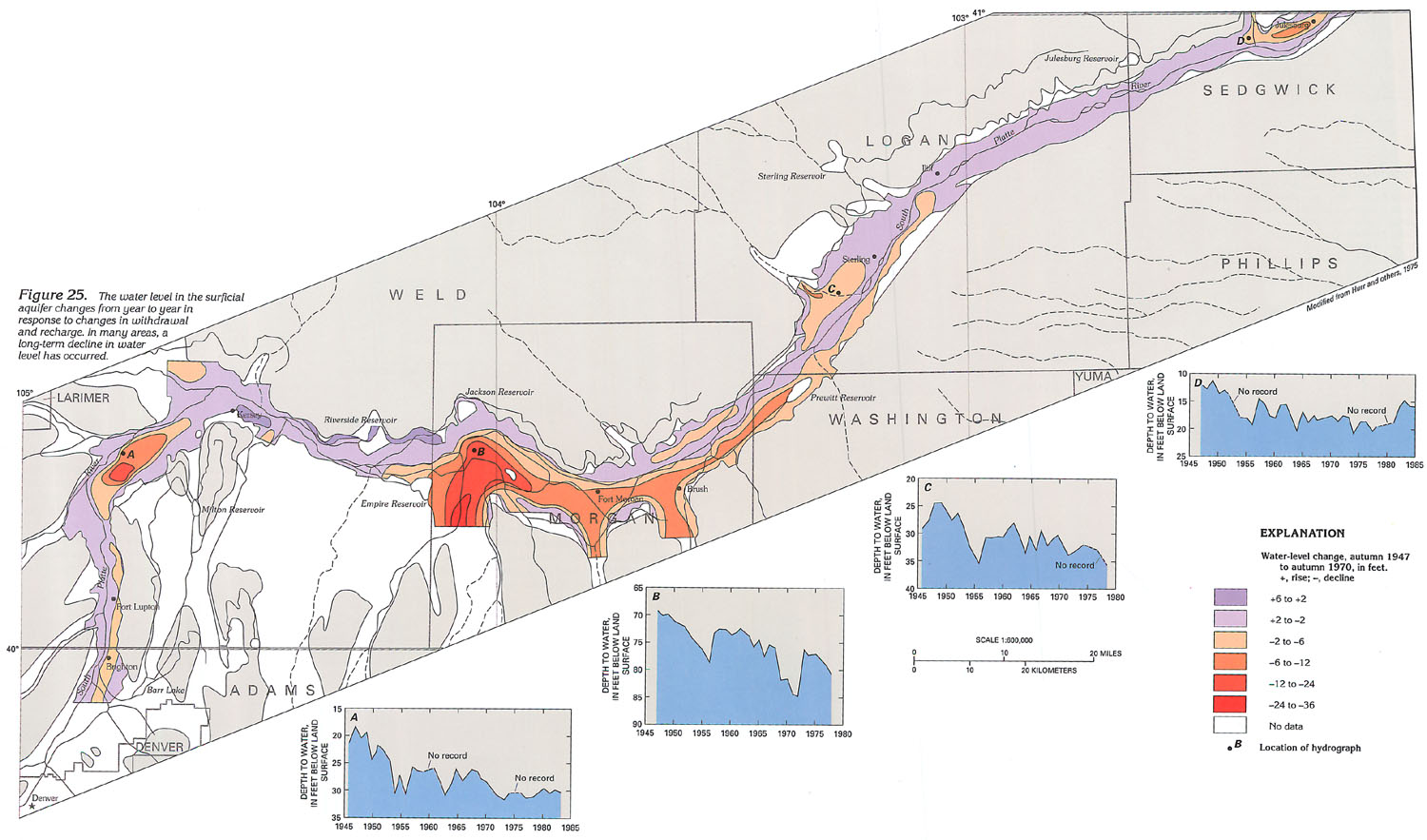 downloadable tiff file C025.tif.gz
(5.8MB compressed)
downloadable tiff file C025.tif.gz
(5.8MB compressed)