GROUND WATER ATLAS of the UNITED STATES
Oklahoma, Texas
HA 730-E
High Plains aquifer
There are two different files for each illustration
- A 72 ppi GIF file, suitable for screen viewing is accessed through
the thumbnail image
- An eps file, suitable for downloading to be printed or edited is accessed
through the "eps file" link. Most files are Adobe Illustrator
6.0, exceptions are noted. These files have been compressed with GNU's
gzip utility. If your web browser defaults to a screen display of the file,
turn on the "Load to local disk" option before downloading. Download
and process these eps files as ascii, not binary.
Hydrogeologic framework
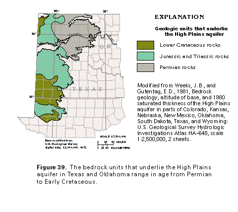
Figure 39 Map showing geologic units that underlie the High Plains
aquifer (17K)
 editable eps file E039.eps.gz
(83K compressed)
editable eps file E039.eps.gz
(83K compressed)
Figure 40 Correlation chart (17K)
 editable eps file E040.eps.gz
(50K compressed)
editable eps file E040.eps.gz
(50K compressed)
Figure 41 Map showing base-of-aquifer contour (17K)
 editable eps file E041.eps.gz
(83K compressed)
editable eps file E041.eps.gz
(83K compressed)
Figure 42 Map showing water-table contour (17K)
 editable eps file E042.eps.gz
(83K compressed)
editable eps file E042.eps.gz
(83K compressed)
Ground-water hydraulics
Figure 43 Map showing hydraulic conductivity (33K)
 editable eps file E043.eps.gz
(99K compressed)
editable eps file E043.eps.gz
(99K compressed)
Figure 44 Map showing specific yield (33K)
 editable eps file E044.eps.gz
(116K compressed)
editable eps file E044.eps.gz
(116K compressed)
 editable eps file E039.eps.gz
(83K compressed)
editable eps file E039.eps.gz
(83K compressed) 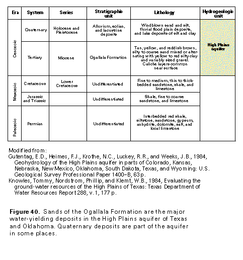 editable eps file E040.eps.gz
(50K compressed)
editable eps file E040.eps.gz
(50K compressed) 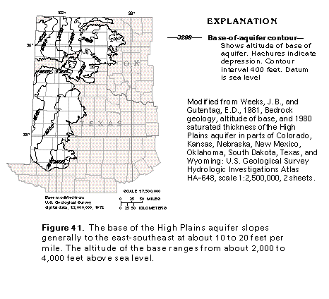 editable eps file E041.eps.gz
(83K compressed)
editable eps file E041.eps.gz
(83K compressed) 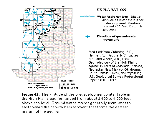 editable eps file E042.eps.gz
(83K compressed)
editable eps file E042.eps.gz
(83K compressed) 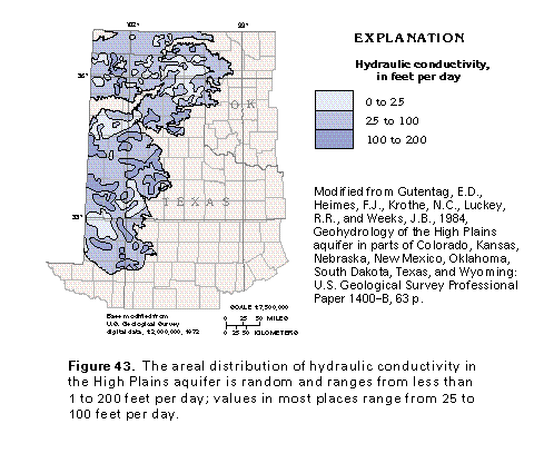 editable eps file E043.eps.gz
(99K compressed)
editable eps file E043.eps.gz
(99K compressed) 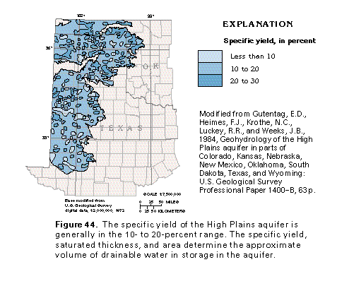 editable eps file E044.eps.gz
(116K compressed)
editable eps file E044.eps.gz
(116K compressed)