GROUND WATER ATLAS of the UNITED STATES
Oklahoma, Texas
HA 730-E
High Plains aquifer
There are two different files for each illustration
- A 72 ppi GIF file, suitable for screen viewing is accessed through
the thumbnail image
- An eps file, suitable for downloading to be printed or edited is accessed
through the "eps file" link. Most files are Adobe Illustrator
6.0, exceptions are noted. These files have been compressed with GNU's
gzip utility. If your web browser defaults to a screen display of the file,
turn on the "Load to local disk" option before downloading. Download
and process these eps files as ascii, not binary.
Ground-water development
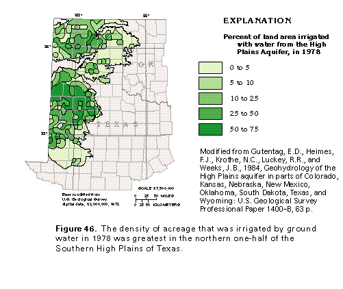
Figure 46 Map showing percent of land area irrigated with water from
the High Plains aquifer (33K)
 editable eps file E046.eps.gz
(116K compressed)
editable eps file E046.eps.gz
(116K compressed)
Figure 47 Map showing water-table contour (17K)
 editable eps file E047.eps.gz
(83K compressed)
editable eps file E047.eps.gz
(83K compressed)
Figure 48 Map showing net water-level change predevelopment
to 1980 (33K)
 editable eps file E048.eps.gz
(83K compressed)
editable eps file E048.eps.gz
(83K compressed)
Figure 49 Map showing Saturated thickness (33K)
 editable eps file E049.eps.gz
(99K compressed)
editable eps file E049.eps.gz
(99K compressed)
Figure 50 Map showing Depth to water in 1980 (33K)
 editable eps file E050.eps.gz
(99K compressed)
editable eps file E050.eps.gz
(99K compressed)
 editable eps file E046.eps.gz
(116K compressed)
editable eps file E046.eps.gz
(116K compressed) 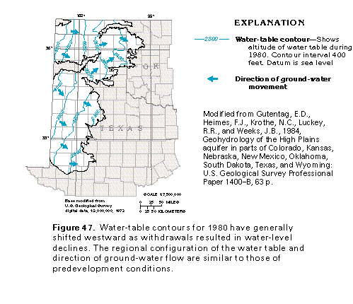 editable eps file E047.eps.gz
(83K compressed)
editable eps file E047.eps.gz
(83K compressed) 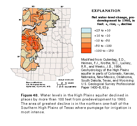 editable eps file E048.eps.gz
(83K compressed)
editable eps file E048.eps.gz
(83K compressed) 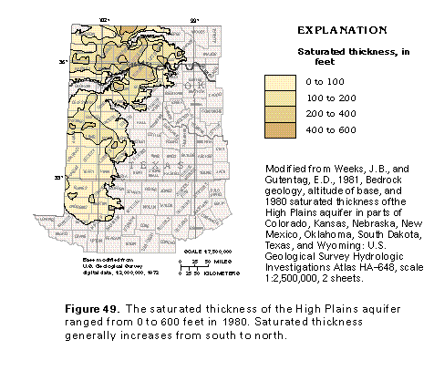 editable eps file E049.eps.gz
(99K compressed)
editable eps file E049.eps.gz
(99K compressed) 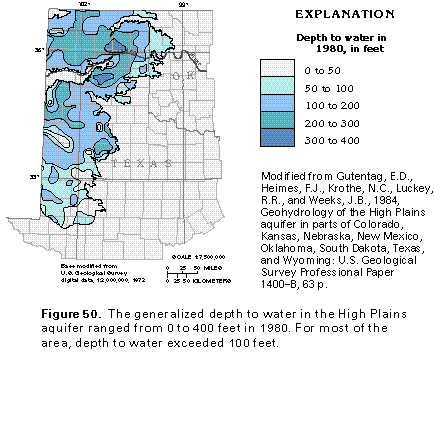 editable eps file E050.eps.gz
(99K compressed)
editable eps file E050.eps.gz
(99K compressed)