GROUND WATER ATLAS of the UNITED STATES
Oklahoma, Texas
HA 730-E
Seymour aquifer
There are two different files for each illustration
- A 72 ppi GIF file, suitable for screen viewing is accessed through
the thumbnail image
- An eps file, suitable for downloading to be printed or edited is accessed
through the "eps file" link. Most files are Adobe Illustrator
6.0, exceptions are noted. These files have been compressed with GNU's
gzip utility. If your web browser defaults to a screen display of the file,
turn on the "Load to local disk" option before downloading. Download
and process these eps files as ascii, not binary.
Seymour aquifer in Haskell and Knox Counties
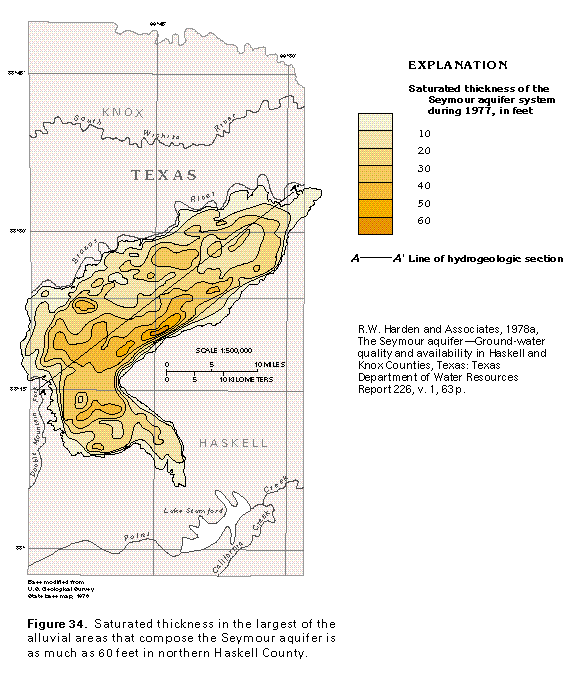
Figure 34 Map showing saturated thickness (33K)
 editable eps file E034.eps.gz
(99K compressed)
editable eps file E034.eps.gz
(99K compressed)
Figure 35 Hydrogeologic section (17K)
 editable eps file E035.eps.gz
(33K compressed)
editable eps file E035.eps.gz
(33K compressed)
Figure 36 Map showing potentiometric contour (33K)
 editable eps file E036.eps.gz
(83K compressed)
editable eps file E036.eps.gz
(83K compressed)
 editable eps file E034.eps.gz
(99K compressed)
editable eps file E034.eps.gz
(99K compressed) 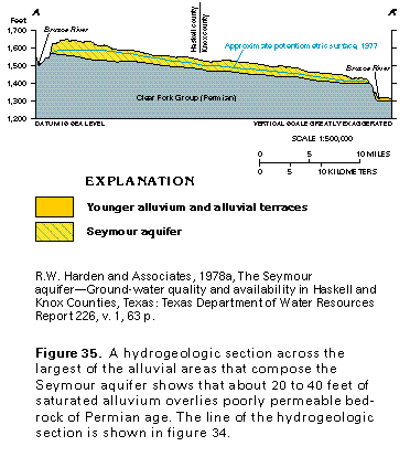 editable eps file E035.eps.gz
(33K compressed)
editable eps file E035.eps.gz
(33K compressed) 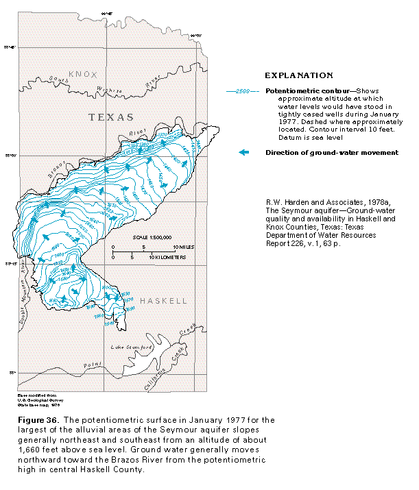 editable eps file E036.eps.gz
(83K compressed)
editable eps file E036.eps.gz
(83K compressed)