GROUND WATER ATLAS of the UNITED STATES
Arkansas, Louisiana, Mississippi
HA 730-F
Regional summary
There are two different files for each illustration
- A 72 ppi GIF file, suitable for screen viewing is accessed through
the thumbnail image
- An eps file, suitable for downloading to be printed or edited is accessed
through the "eps file" link. Most files are Adobe Illustrator
6.0, exceptions are noted. These files have been compressed with GNU's
gzip utility. If your web browser defaults to a screen display of the file,
turn on the "Load to local disk" option before downloading. Download
and process these eps files as ascii, not binary.
Major aquifers
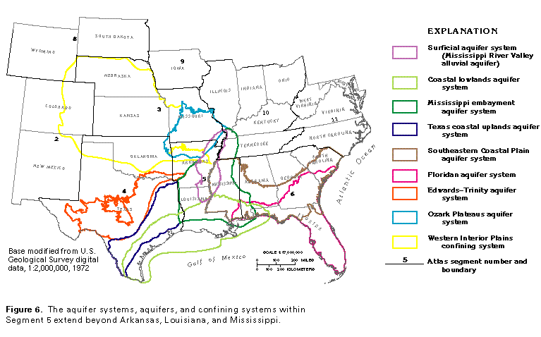
Figure 6 Map showing aquifer, aquifer system and confining system
extents (97K)
 editable eps file F006.eps.gz
(291K compressed)
editable eps file F006.eps.gz
(291K compressed)
Figure 7 Map showing principal aquifers (160K)
 editable eps file F007.eps.gz
(1M compressed)
editable eps file F007.eps.gz
(1M compressed)
Figure 8 Map showing Surficial aquifer system extent
(97K)
 editable eps file F008.eps.gz
(970K compressed)
editable eps file F008.eps.gz
(970K compressed)
Figure 9 Map showing Coastal lowlands aquifer system
extent (97K)
 editable eps file F009.eps.gz
(970K compressed)
editable eps file F009.eps.gz
(970K compressed)
Figure 10 Map showing Mississippi embayment aquifer
system extent (97K)
 editable eps file F010.eps.gz
(970K compressed)
editable eps file F010.eps.gz
(970K compressed)
Figure 11 Map showing Cretaceous aquifers and aquifer
systems extent (97K)
 editable eps file F011.eps.gz
(970K compressed)
editable eps file F011.eps.gz
(970K compressed)
Figure 12 Map showing Ozark Plateaus aquifer system,
Western Interior Plains confining system and the Ouachita Mountains aquifer
(97K)
 editable eps file F012.eps.gz
(1MB compressed)
editable eps file F012.eps.gz
(1MB compressed)
 editable eps file F006.eps.gz
(291K compressed)
editable eps file F006.eps.gz
(291K compressed) 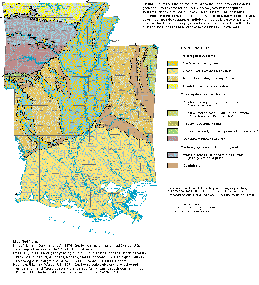 editable eps file F007.eps.gz
(1M compressed)
editable eps file F007.eps.gz
(1M compressed)