GROUND WATER ATLAS of the UNITED STATES
Arkansas, Louisiana, Mississippi
HA 730-F
Regional summary
There are two different files for each illustration
- A 72 ppi GIF file, suitable for screen viewing is accessed through
the thumbnail image
- An eps file, suitable for downloading to be printed or edited is accessed
through the "eps file" link. Most files are Adobe Illustrator
6.0, exceptions are noted. These files have been compressed with GNU's
gzip utility. If your web browser defaults to a screen display of the file,
turn on the "Load to local disk" option before downloading. Download
and process these eps files as ascii, not binary.
Fresh ground-water withdrawals
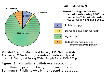
Figure 17 Chart showing the use of fresh ground-water withdrawals
during 1985 by county (97K)
 editable eps file F017.eps.gz
(97K compressed)
editable eps file F017.eps.gz
(97K compressed)
Figure 18 Graph showing fresh ground-water withdrawals
by state and year (97K)
 editable eps file F018.eps.gz
(97K compressed)
editable eps file F018.eps.gz
(97K compressed)
Figure 19 Map showing fresh ground-water withdrawals
during 1985 by county (97K)
 editable eps file F019.eps.gz
(388K compressed)
editable eps file F019.eps.gz
(388K compressed)
Figure 20 Graph showing fresh ground-water withdrawals
by aquifer (97K)
 editable eps file F020.eps.gz
(97K compressed)
editable eps file F020.eps.gz
(97K compressed)
Figure 21 Map showing recharge and discharge before
development (97K)
 editable eps file F021.eps.gz
(388K compressed)
editable eps file F021.eps.gz
(388K compressed)
Figure 22 Map showing recharge and discharge (97K)
 editable eps file F022.eps.gz
(388K compressed)
editable eps file F022.eps.gz
(388K compressed)
 editable eps file F017.eps.gz
(97K compressed)
editable eps file F017.eps.gz
(97K compressed) 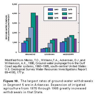 editable eps file F018.eps.gz
(97K compressed)
editable eps file F018.eps.gz
(97K compressed) 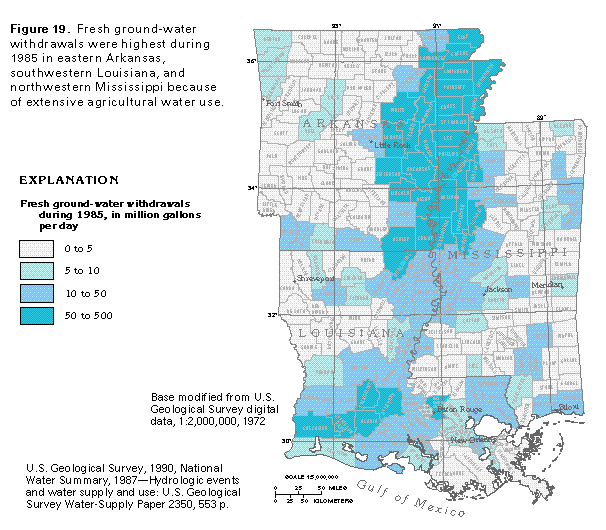 editable eps file F019.eps.gz
(388K compressed)
editable eps file F019.eps.gz
(388K compressed) 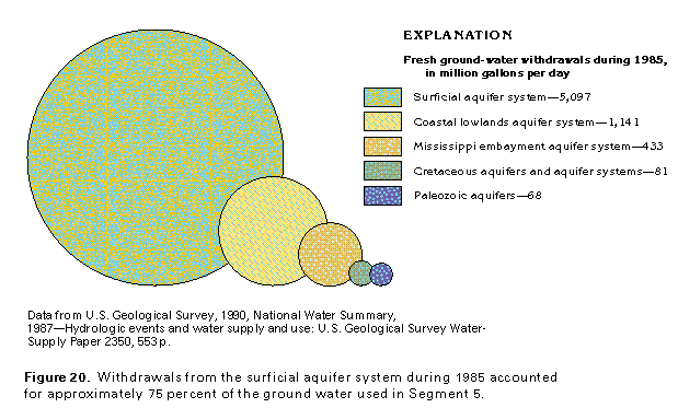 editable eps file F020.eps.gz
(97K compressed)
editable eps file F020.eps.gz
(97K compressed) 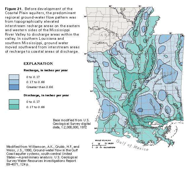 editable eps file F021.eps.gz
(388K compressed)
editable eps file F021.eps.gz
(388K compressed) 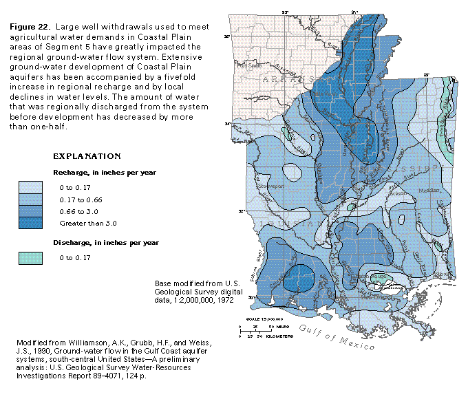 editable eps file F022.eps.gz
(388K compressed)
editable eps file F022.eps.gz
(388K compressed)