GROUND WATER ATLAS of the UNITED STATES
Alabama, Florida, Georgia, and South Carolina
HA 730-G
Appalachian Plateaus and Interior Low Plateaus aquifers
There are two different files for each illustration
- A 90 ppi JPEG file, suitable for screen viewing is accessed
through the thumbnail image.
-
- A tiff file is accessed through the "tiff file"
link. All files are Adobe Photoshop. These files have been compressed
with GNU's gzip utility. If your web browser defaults to a screen
display of the file, turn on the "Load to local disk"
option before downloading. Download and process these tiff files
as ascii, not binary.
Introduction
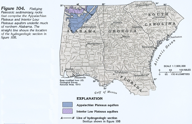
Figure 104 Map showing the location of the Appalachian Plateaus
and Interior Low Plateaus aquifers (272K)
 downloadable tiff file G104.tif.gz (2.1MB
compressed)
downloadable tiff file G104.tif.gz (2.1MB
compressed)
Figure 105 Photograph showing example of sediment-filled
vertical joints in massive horizontally bedded limestone rocks
(272K)
 downloadable tiff file G105.tif.gz (2.4MB
compressed)
downloadable tiff file G105.tif.gz (2.4MB
compressed)
Figure 106 Photograph showing example of thin-bedded
rocks such as the Fort Payne Chert in the Appalachian Plateaus
and Interior Low Plateaus aquifers (280K)
 downloadable tiff file G106.tif.gz (2.3MB
compressed)
downloadable tiff file G106.tif.gz (2.3MB
compressed)
 downloadable tiff file G104.tif.gz (2.1MB
compressed)
downloadable tiff file G104.tif.gz (2.1MB
compressed) 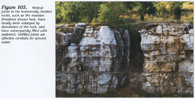 downloadable tiff file G105.tif.gz (2.4MB
compressed)
downloadable tiff file G105.tif.gz (2.4MB
compressed) 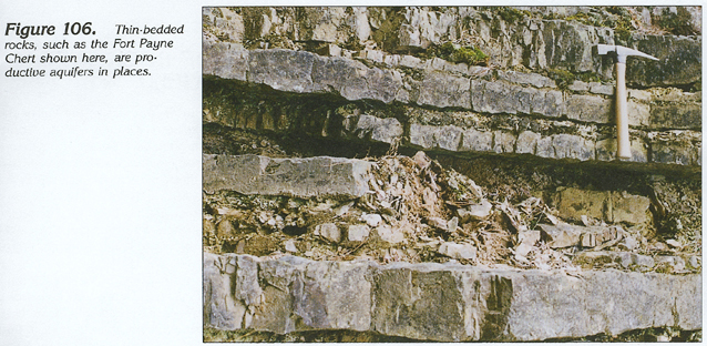 downloadable tiff file G106.tif.gz (2.3MB
compressed)
downloadable tiff file G106.tif.gz (2.3MB
compressed)