GROUND WATER ATLAS of the UNITED STATES
Alabama, Florida, Georgia, and South Carolina
HA 730-G
Floridan aquifer system
There are two different files for each illustration
- A 90 ppi JPEG file, suitable for screen viewing is accessed
through the thumbnail image.
- A tiff file is accessed through the "tiff file"
link. All files are Adobe Photoshop. These files have been compressed
with GNU's gzip utility. If your web browser defaults to a screen
display of the file, turn on the "Load to local disk"
option before downloading. Download and process these tiff files
as ascii, not binary.
Hydrogeologic Units
Figure 49 Correlation chart showing the geologic formations
that comprise the Floridan aquifer system (496K)
 downloadable tiff file G049.tif.gz (4.2MB
compressed)
downloadable tiff file G049.tif.gz (4.2MB
compressed)
Aquifers and Confining Units
Figure 50 Correlation chart showing the permeability characteristics
of the Floridan aquifer system (296K)
 downloadable tiff file G050.tif.gz (2.5MB
compressed)
downloadable tiff file G050.tif.gz (2.5MB
compressed)
Thickness
Figure 51 Map showing thickness of the Floridan aquifer system
(628K)
 downloadable tiff file G051.tif.gz (4.9MB
compressed)
downloadable tiff file G051.tif.gz (4.9MB
compressed)
 downloadable tiff file G049.tif.gz (4.2MB
compressed)
downloadable tiff file G049.tif.gz (4.2MB
compressed) 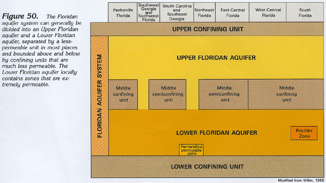 downloadable tiff file G050.tif.gz (2.5MB
compressed)
downloadable tiff file G050.tif.gz (2.5MB
compressed) 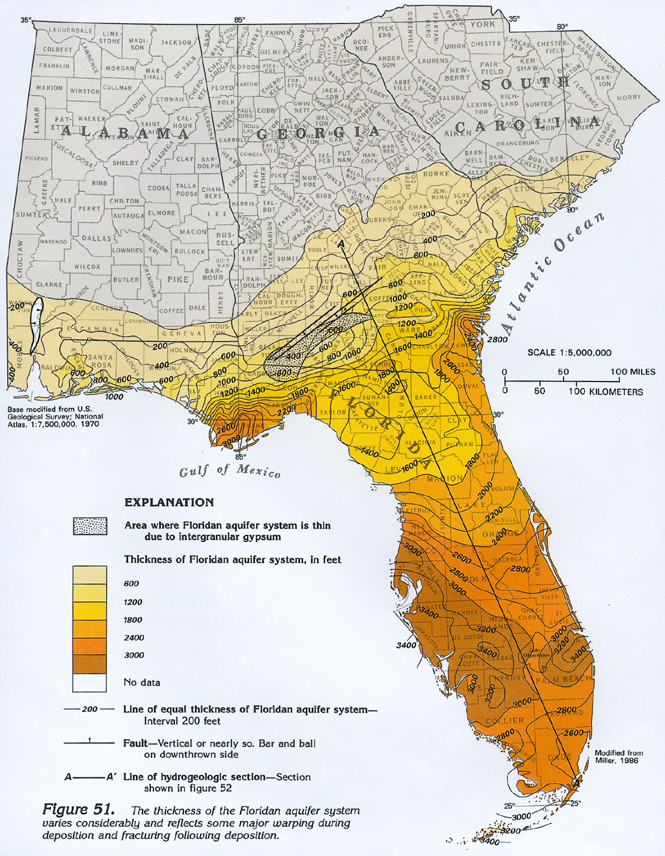 downloadable tiff file G051.tif.gz (4.9MB
compressed)
downloadable tiff file G051.tif.gz (4.9MB
compressed)