GROUND WATER ATLAS of the UNITED STATES
Alabama, Florida, Georgia, and South Carolina
HA 730-G
Southeastern Coastal Plain aquifer system
There are two different files for each illustration
- A 90 ppi JPEG file, suitable for screen viewing is accessed
through the thumbnail image.
- A tiff file is accessed through the "tiff file"
link. All files are Adobe Photoshop. These files have been compressed
with GNU's gzip utility. If your web browser defaults to a screen
display of the file, turn on the "Load to local disk"
option before downloading. Download and process these tiff files
as ascii, not binary.
Ground-water Flow
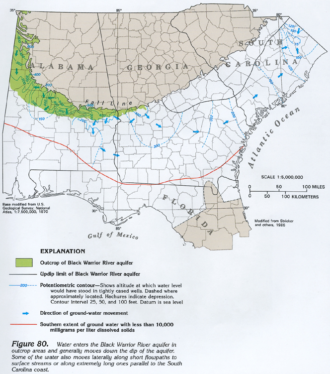
Figure 80 Map showing the location of Black Warrior River aquifer
outcropping and the ground-water movement through the aquifer
(448K)
 downloadable tiff file G080.tif.gz (3.6MB
compressed)
downloadable tiff file G080.tif.gz (3.6MB
compressed)
Figure 81 Diagrammatic section showing general movement of
water from the Southeastern Coastal Plain aquifer system to the
Floridan aquifer system (308K)
 downloadable tiff file G081.tif.gz (2.1MB
compressed)
downloadable tiff file G081.tif.gz (2.1MB
compressed)
 downloadable tiff file G080.tif.gz (3.6MB
compressed)
downloadable tiff file G080.tif.gz (3.6MB
compressed) 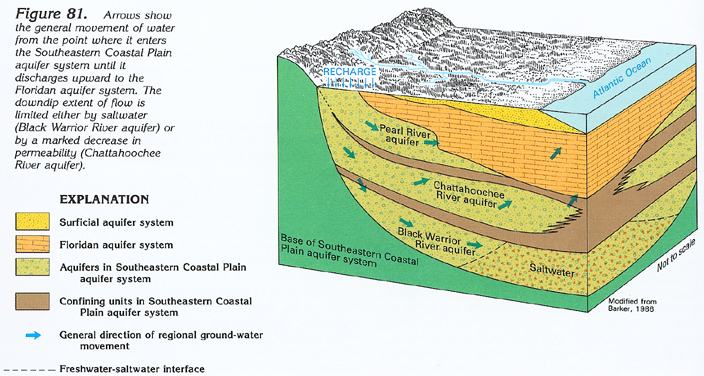 downloadable tiff file G081.tif.gz (2.1MB
compressed)
downloadable tiff file G081.tif.gz (2.1MB
compressed)