GROUND WATER ATLAS of the UNITED STATES
Alabama, Florida, Georgia, and South Carolina
HA 730-G
Valley and Ridge aquifers
There are two different files for each illustration
- A 90 ppi JPEG file, suitable for screen viewing is accessed
through the thumbnail image.
-
- A tiff file is accessed through the "tiff file"
link. All files are Adobe Photoshop. These files have been compressed
with GNU's gzip utility. If your web browser defaults to a screen
display of the file, turn on the "Load to local disk"
option before downloading. Download and process these tiff files
as ascii, not binary.
Introduction
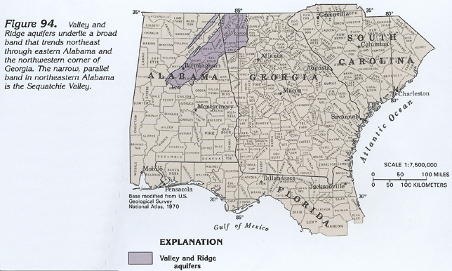
Figure 94 Map showing the location of the Valley and Ridge
aquifers (264K)
 downloadable tiff file G094.tif.gz (2.1MB
compressed)
downloadable tiff file G094.tif.gz (2.1MB
compressed)
Figure 95 Photograph showing example of intense
folding in the Valley and Ridge physiographic province (316K)
 downloadable tiff file G095.tif.gz (2.5MB
compressed)
downloadable tiff file G095.tif.gz (2.5MB
compressed)
Figure 96 Photograph showing example of a thrust
fault in the Valley and Ridge physiographic province (280K)
 downloadable tiff file G096.tif.gz (2.4MB
compressed)
downloadable tiff file G096.tif.gz (2.4MB
compressed)
 downloadable tiff file G094.tif.gz (2.1MB
compressed)
downloadable tiff file G094.tif.gz (2.1MB
compressed) 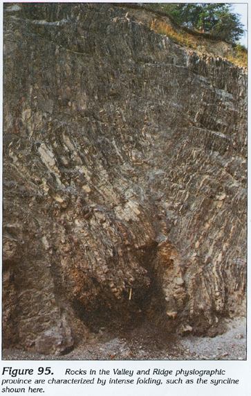 downloadable tiff file G095.tif.gz (2.5MB
compressed)
downloadable tiff file G095.tif.gz (2.5MB
compressed) 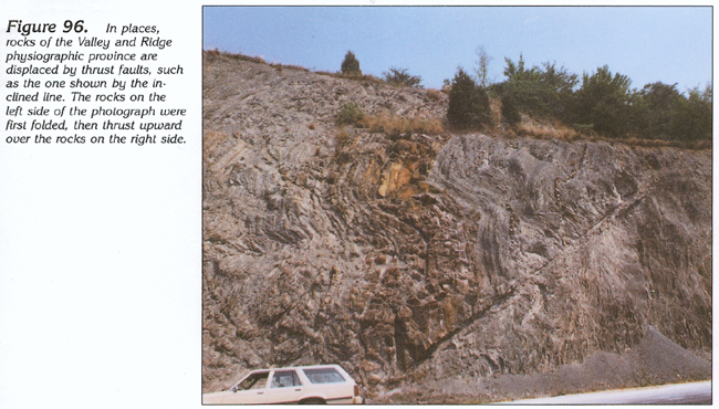 downloadable tiff file G096.tif.gz (2.4MB
compressed)
downloadable tiff file G096.tif.gz (2.4MB
compressed)