GROUND WATER ATLAS of the UNITED STATES
Alabama, Florida, Georgia, and South Carolina
HA 730-G
Regional summary
There are two different files for each illustration
- A 90 ppi JPEG file, suitable for screen viewing is accessed
through the thumbnail image.
- A tiff file is accessed through the "tiff file"
link. All files are Adobe Photoshop. These files have been compressed
with GNU's gzip utility. If your web browser defaults to a screen
display of the file, turn on the "Load to local disk"
option before downloading. Download and process these tiff files
as ascii, not binary.
Geology
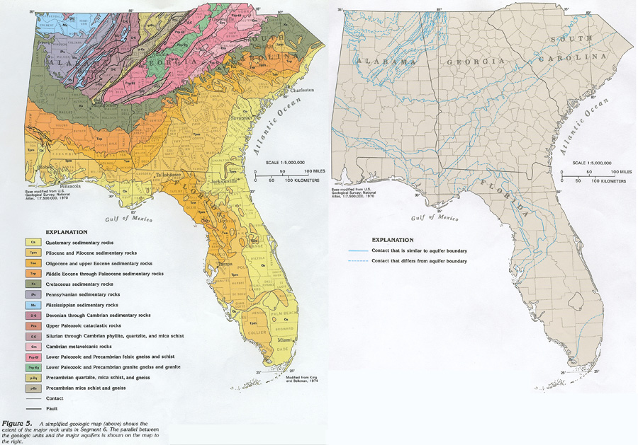
Figure 5 Maps showing the parallel between the geologic
units and the major aquifers (272K)
 downloadable tiff file G005.tif.gz (10.5MB
compressed)
downloadable tiff file G005.tif.gz (10.5MB
compressed)
Figure 6 Diagrammatic section showing the general
relationship of the four major categories of geologic structure
(400K)
 downloadable tiff file G006.tif.gz (3.2MB
compressed)
downloadable tiff file G006.tif.gz (3.2MB
compressed)
 downloadable tiff file G005.tif.gz (10.5MB
compressed)
downloadable tiff file G005.tif.gz (10.5MB
compressed) 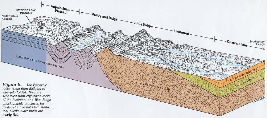 downloadable tiff file G006.tif.gz (3.2MB
compressed)
downloadable tiff file G006.tif.gz (3.2MB
compressed)