GROUND WATER ATLAS of the UNITED STATES
Idaho, Oregon, Washington
HA 730-H
Northern Rocky Mountains intermontane basins regional aquifer
system
There are two different files for each illustration
- A 90 ppi JPEG file, suitable for screen viewing is accessed
through the thumbnail image.
- A tiff file is accessed through the "tiff file"
link. All files are Adobe Photoshop. These files have been compressed
with GNU's gzip utility. If your web browser defaults to a screen
display of the file, turn on the "Load to local disk"
option before downloading. Download and process these tiff files
as ascii, not binary.
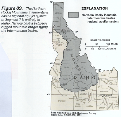
Figure 89 Map showing location of the Northern Rocky
Mountains intermontane basins regional aquifer system (148K)
 downloadable
tiff file H089.tif.gz (1.1MB
compressed)
downloadable
tiff file H089.tif.gz (1.1MB
compressed)
Figure 90 Map showing areal extent of the
Northern Rocky Mountains intermontane basins regional aquifer
system (152K)
 downloadable tiff
file H090.tif.gz (3.2MB compressed)
downloadable tiff
file H090.tif.gz (3.2MB compressed)
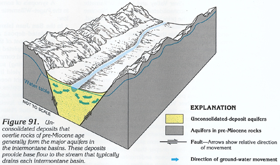
Figure 91 Cross-section showing aquifers
in the pre-Miocene rocks forming the intermontane basins (168K)
 downloadable
tiff file H091.tif.gz (1.2MB
compressed)
downloadable
tiff file H091.tif.gz (1.2MB
compressed)
Figure 92 Photograph showing fault along
valley margin (132K)
 downloadable
tiff file H092.tif.gz (1MB
compressed)
downloadable
tiff file H092.tif.gz (1MB
compressed)
Table 6 Chart showing showing ground-water conditions
in the Northern Rocky Mountains intermontane basins regional aquifer
system in Idaho(316K)
 downloadable
tiff file Htab6.tif.gz
(2.2MB compressed)
downloadable
tiff file Htab6.tif.gz
(2.2MB compressed)
Return to Northern Rocky Mountains
intermontane basins regional aquifer system text
Return to HA 730-H table of contents
Return to Ground Water Atlas home page
 downloadable
tiff file H089.tif.gz (1.1MB
compressed)
downloadable
tiff file H089.tif.gz (1.1MB
compressed) 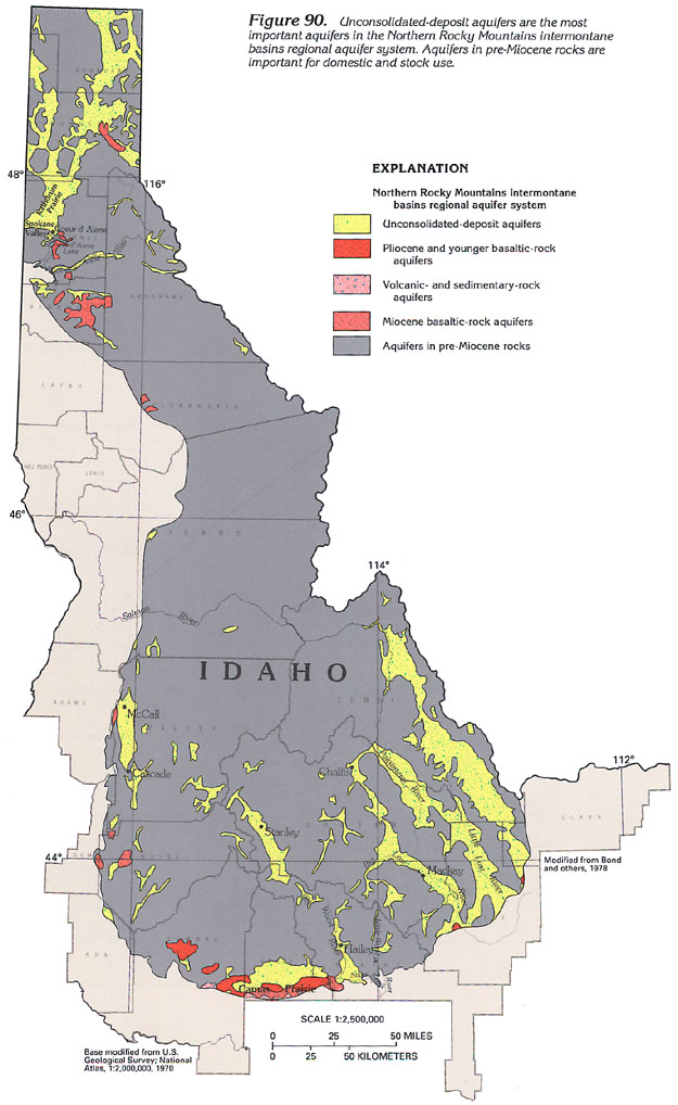 downloadable tiff
file H090.tif.gz (3.2MB compressed)
downloadable tiff
file H090.tif.gz (3.2MB compressed)
 downloadable
tiff file H091.tif.gz (1.2MB
compressed)
downloadable
tiff file H091.tif.gz (1.2MB
compressed) 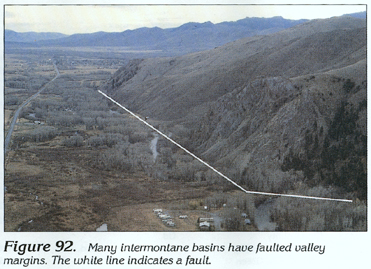 downloadable
tiff file H092.tif.gz (1MB
compressed)
downloadable
tiff file H092.tif.gz (1MB
compressed) 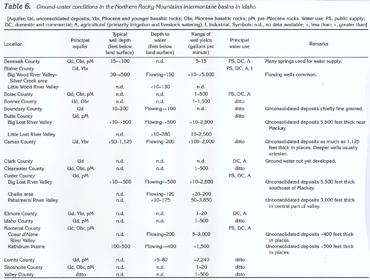 downloadable
tiff file Htab6.tif.gz
(2.2MB compressed)
downloadable
tiff file Htab6.tif.gz
(2.2MB compressed)